There are over 200 photos here, so even the small version will take several seconds to load. Please be patient.
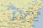 It's been a couple of years since our last trip to a Grumman convention.
This year's gathering was so close to home that it could have
been a day trip – Glens Falls, New York, 132 nautical
miles from home base.
It's been a couple of years since our last trip to a Grumman convention.
This year's gathering was so close to home that it could have
been a day trip – Glens Falls, New York, 132 nautical
miles from home base.
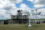
 Last October, the Northeast Region AYA held a fly-in to the same airport, to
check out the airport and try the convention hotel for lunch.
Last October, the Northeast Region AYA held a fly-in to the same airport, to
check out the airport and try the convention hotel for lunch.

 After Brooklyn's Floyd Bennett Field was closed, Glens Falls named its
airport for Bennett, who grew up in this area. He was the pilot who flew
Admiral Byrd from Spitsbergen to the North Pole and back in May 1926. This
feat earned both men the Medal of
Honor, which is extremely unusual in peacetime. Bennett is buried in
Arlington National Cemetery. This photo hangs in the terminal building.
After Brooklyn's Floyd Bennett Field was closed, Glens Falls named its
airport for Bennett, who grew up in this area. He was the pilot who flew
Admiral Byrd from Spitsbergen to the North Pole and back in May 1926. This
feat earned both men the Medal of
Honor, which is extremely unusual in peacetime. Bennett is buried in
Arlington National Cemetery. This photo hangs in the terminal building.
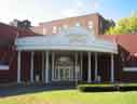

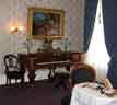
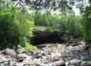
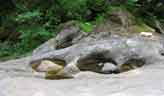
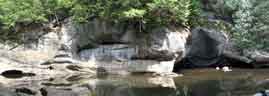
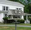
 The convention hotel was the Queensbury in downtown Glens Falls. In their
lobby hangs a large painting of Cooper's Cave, which is nearby. This cave
inspired James Fenimore Cooper while he was writing The Last of the
Mohicans. These days, you can't get inside the cave, but you can get
close enough for a good look.
The convention hotel was the Queensbury in downtown Glens Falls. In their
lobby hangs a large painting of Cooper's Cave, which is nearby. This cave
inspired James Fenimore Cooper while he was writing The Last of the
Mohicans. These days, you can't get inside the cave, but you can get
close enough for a good look.
 Between the Hotel and Cooper's Cave, you walk past a stairway to nowhere.
 Each September,
Glens Falls is home to the largest
balloon gathering east of the Mississippi.
The organizers are recognized by a monument in Shepard Park, in nearby Lake
George Village.
Each September,
Glens Falls is home to the largest
balloon gathering east of the Mississippi.
The organizers are recognized by a monument in Shepard Park, in nearby Lake
George Village.
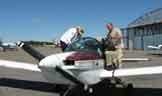
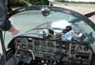

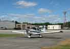
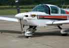
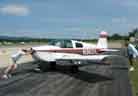
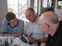
Ni Thomas, Jörg Trauboth, and Peter Ruwe flew one of our club Tigers to the convention. Saturday morning before the convention, they busied themselves with packing and preparing the plane. Most of the attention seemed to be spent on setting up the two portable GPS units. Finally, they were ready for engine start, with Jörg taking the first leg.
 Ni brought his customary flying companion. The bird acquired a playmate and
a new family before leaving Glens Falls this year.
Ni brought his customary flying companion. The bird acquired a playmate and
a new family before leaving Glens Falls this year.
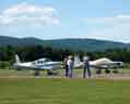
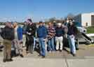
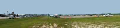
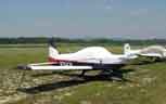
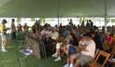
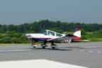
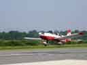
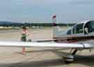
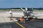
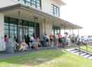
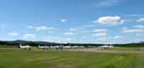 The shots at right were taken Saturday.
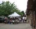
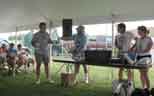
The convention didn't even start until Monday
afternoon, and there was already a good group gathered in the Grumman parking
area. But it turned out to be a fairly small gathering — about 90
Grummans, and 165 people. The tall man at right in the second photo is
Marshall Stevens, the airport manager. When the boss comes out to help the
line crew, you know it's a good sign. Everybody at the airport and FBO went
out of their way to make the convention a roaring success.
The shots at right were taken Saturday.
The convention didn't even start until Monday
afternoon, and there was already a good group gathered in the Grumman parking
area. But it turned out to be a fairly small gathering — about 90
Grummans, and 165 people. The tall man at right in the second photo is
Marshall Stevens, the airport manager. When the boss comes out to help the
line crew, you know it's a good sign. Everybody at the airport and FBO went
out of their way to make the convention a roaring success.
 It's official, now. Roscoe has arrived.
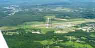
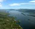
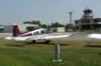
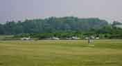
 Barbara and I flew to the convention a day after the previous
photos were shot. We
examined the convention city and the airport from the air.
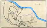
Hudson Falls is in the foreground,
Glens Falls in the background. The airport shows a slightly expanded flight
line compared to the previous photo. In the first photo, it would be
slightly off-screen to the right.
Barbara and I flew to the convention a day after the previous
photos were shot. We
examined the convention city and the airport from the air.
Hudson Falls is in the foreground,
Glens Falls in the background. The airport shows a slightly expanded flight
line compared to the previous photo. In the first photo, it would be
slightly off-screen to the right.
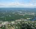
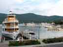
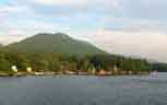
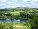
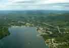 Rather than the convention hotel, we chose to stay in Lake George Village,
where we could easily walk to the resort town in the evening. Here are aerial
views of Lake George and the Village, about seven miles from the convention
airport.
Rather than the convention hotel, we chose to stay in Lake George Village,
where we could easily walk to the resort town in the evening. Here are aerial
views of Lake George and the Village, about seven miles from the convention
airport.
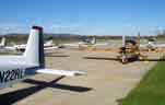
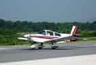
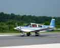
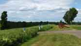
By Tuesday morning, the flight line had expanded to over six dozen airplanes.
So far, all Grummans — in contrast to some previous conventions when a few
rogues sneaked in.
If you'd like to see a larger version of this picture, it's
here.
Bigger yet, send me
email.
Stars and Stripes are a popular motif. Here are some examples from this year's flight line.

 Our President brought his usual travelling companion.

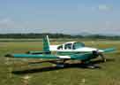
A nice two-place belonging to Steve Roberts.
 One of the flying events was a Geological Air Rally. Although weather
postponed the flight by one day,
the preparatory seminar was on schedule. Yale University's
Dr. Leo Hickey
explained how the area near the convention site was formed, roughly 400
million years ago.
Our good fortune in getting a speaker of this caliber had a lot to do with
the special influence of one of our
convention chairmen.
One of the flying events was a Geological Air Rally. Although weather
postponed the flight by one day,
the preparatory seminar was on schedule. Yale University's
Dr. Leo Hickey
explained how the area near the convention site was formed, roughly 400
million years ago.
Our good fortune in getting a speaker of this caliber had a lot to do with
the special influence of one of our
convention chairmen.
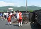
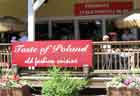
One of the off-airport convention activities was a tour of Ft. William Henry in Lake George Village, a few minutes' bus ride from the convention hotel. Lake George was a vital transportation link in the 18th and 19th Centuries. Lake Champlain drains into the St. Lawrence River, giving access to Toronto, Montreal, and the once-fertile fishing grounds of the North Atlantic. The Hudson River gives access to New York and the main shipping routes of the Atlantic. Lake George connected Lake Champlain with the Hudson River by short portages at its north end, near Ft. Ticonderoga, and its south end, near Ft. William Henry (today's Lake George Village). In the 19th century, the portages were replaced with canals.
 Fort William Henry was the site of an important siege in the French and Indian
War
(for European readers, that's the Seven Years War, which lasted nine years).
The French General Montcalm took command of this site in August 1757, driving
the English to evacuate to Fort Edward on the Hudson River. The restoration
that we toured was built on the footprint of the original fort, and the tour
predictably focusses on how life was lived there before Montcalm took over.
Fort William Henry was the site of an important siege in the French and Indian
War
(for European readers, that's the Seven Years War, which lasted nine years).
The French General Montcalm took command of this site in August 1757, driving
the English to evacuate to Fort Edward on the Hudson River. The restoration
that we toured was built on the footprint of the original fort, and the tour
predictably focusses on how life was lived there before Montcalm took over.

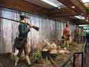
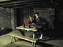
 We learned how to load and fire a long gun and a cannon, and how to make
musket balls.
We learned how to load and fire a long gun and a cannon, and how to make
musket balls.
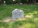 Many died here, and most of the bodies were not identified. When the site
was re-created in 1953, the remains of several unknown soldiers were
relocated a few hundred yards to a new cemetery at the fort.
Many died here, and most of the bodies were not identified. When the site
was re-created in 1953, the remains of several unknown soldiers were
relocated a few hundred yards to a new cemetery at the fort.
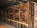 The dungeon was a surprisingly refreshing place to visit. It was a hot day,
and this place was one floor down from the surface.
The dungeon was a surprisingly refreshing place to visit. It was a hot day,
and this place was one floor down from the surface.
Near the dungeon, there is a model of its guard station.
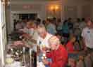 That evening, there was an ice cream social mixer...
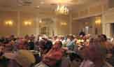
 ... followed by the general business meeting.
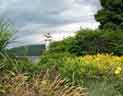
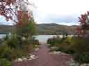
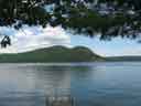
 Lake George is a popular resort. Although we were there in "shoulder season,"
there was already plenty of activity in town.
Lake George is a popular resort. Although we were there in "shoulder season,"
there was already plenty of activity in town.
 The Mohawk called the lake "Horicon," which is now the name of a town in the
vicinity. In 1646, Father Isaac Jogues was the first white man to see the
lake. He called it "Lac du St. Sacrement," which is now the name of the
largest tour boat on the lake. The modern name honors King George II of
England. The lake is 32 miles long, with over 159 miles of shoreline and 179
islands. It is three miles across at its widest point,
and reaches a depth of 187 feet.
The Mohawk called the lake "Horicon," which is now the name of a town in the
vicinity. In 1646, Father Isaac Jogues was the first white man to see the
lake. He called it "Lac du St. Sacrement," which is now the name of the
largest tour boat on the lake. The modern name honors King George II of
England. The lake is 32 miles long, with over 159 miles of shoreline and 179
islands. It is three miles across at its widest point,
and reaches a depth of 187 feet.
 Isaac Jogues was born in Orléans, France, in 1607. He was sent to New
France, where he was captured by the Mohawk, along with Guillaume Couture,
René Goupil, and several converted Huron Indians. They were tortured;
the Indians ate or burned several of Father Jogues's fingers
and his thumbs because they believed he
would then be unable to summon his spirit protectors. He lived as a slave
among the Mohawk for some time, but finally escaped and made his way back to
France. Pope Urban VIII granted him special permission to perform the
Mass with his mutilated hands.
Isaac Jogues was born in Orléans, France, in 1607. He was sent to New
France, where he was captured by the Mohawk, along with Guillaume Couture,
René Goupil, and several converted Huron Indians. They were tortured;
the Indians ate or burned several of Father Jogues's fingers
and his thumbs because they believed he
would then be unable to summon his spirit protectors. He lived as a slave
among the Mohawk for some time, but finally escaped and made his way back to
France. Pope Urban VIII granted him special permission to perform the
Mass with his mutilated hands.
Optimistically, he returned to the Mohawk, but they regarded him as a
sorcerer, and after a series of crop failures they clubbed him to death and
cut off his head. Goupil and Jean de Lalande, his ambassador, suffered the
same fate.
Considered a martyr by the Roman Catholic Church, Father Jogues was canonized
in 1930. This memorial stands in Lake George Battlefield Park,
adjacent to Ft. William Henry.
 Near
the Information Center, there's a scale map (1 foot = 1 mile) of the lake
itself.
Near
the Information Center, there's a scale map (1 foot = 1 mile) of the lake
itself.
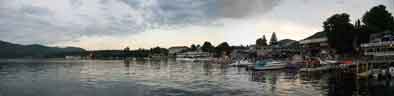
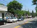
 The village has the usual tourist traps.
It also has some pretty lakeside parks. The first photo is from the October
fly-in. The scene is slightly different in June.
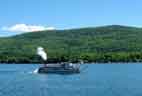 The paddlewheeler Minne-Ha-Ha cruises every couple of hours. While
passengers are boarding, its calliope plays. Loudly. Maybe they get
customers by promising to stop the music when they have enough paying
passengers.
The paddlewheeler Minne-Ha-Ha cruises every couple of hours. While
passengers are boarding, its calliope plays. Loudly. Maybe they get
customers by promising to stop the music when they have enough paying
passengers.
Here's a view of the village waterfront. For a closer look (wide photo!), click this link.
 There are things to see and do in Glens Falls, too. The area was important
because this is the upstream limit of the Hudson River's navigability. In
the 19th Century, it was also the last stop for tourists setting off into the
Adirondack wilderness.
There are things to see and do in Glens Falls, too. The area was important
because this is the upstream limit of the Hudson River's navigability. In
the 19th Century, it was also the last stop for tourists setting off into the
Adirondack wilderness.
 Glens Falls is home to the
Hyde Collection, a significant art museum that
owns several Renaissance masters. These are displayed in the Hyde Mansion,
which is worth a visit even if you don't go to the city for any other reason.
The sculpture outside is A Dancing Family (1970), a bronze by
Milton Hebald.
Glens Falls is home to the
Hyde Collection, a significant art museum that
owns several Renaissance masters. These are displayed in the Hyde Mansion,
which is worth a visit even if you don't go to the city for any other reason.
The sculpture outside is A Dancing Family (1970), a bronze by
Milton Hebald.
 There is also the
Chapman Historical Museum, in the house of Z.I. DeLong.
This house is available for guided tours only, a recommended thing to do.
The house is maintained as it would have been in the late 19th to early 20th
Century. The stuffed birds are under glass because arsenic was used in the
process.
There is also the
Chapman Historical Museum, in the house of Z.I. DeLong.
This house is available for guided tours only, a recommended thing to do.
The house is maintained as it would have been in the late 19th to early 20th
Century. The stuffed birds are under glass because arsenic was used in the
process.

 Glens Falls (the falls) must have been very beautiful before the dam was
built. The rock is Glens Falls Limestone, a hard black rock that resists the
wearing action of water.
But the dam is why the city grew. It harnesses the Hudson River to
power the mills that were the city's industrial base.
Glens Falls (the falls) must have been very beautiful before the dam was
built. The rock is Glens Falls Limestone, a hard black rock that resists the
wearing action of water.
But the dam is why the city grew. It harnesses the Hudson River to
power the mills that were the city's industrial base.
The present dam is the most recent in a series of dams at this site since the
1700s. The first settlers established mills here in the 1760s. At first,
there were lumber mills and gristmills. Then, in the 1800s came the stone
sawmills and the factories. All of these industries ran their machinery by
water power. Toward the end of the 19th and throughout the 20th Century,
paper mills and generating plants on both sides of the Hudson have used this
water power to make electricity.
 Lake George Battlefield Park is next to Ft. William Henry. It's used
mainly as a tranquil site for picnics and other family gatherings.
There are a few monuments and
signs, but very little to remind visitors that this was the site of two bloody
skirmishes in September 1755, ending in the first significant English win
against the French regulars in the American theatre of the Seven Years War.
Lake George Battlefield Park is next to Ft. William Henry. It's used
mainly as a tranquil site for picnics and other family gatherings.
There are a few monuments and
signs, but very little to remind visitors that this was the site of two bloody
skirmishes in September 1755, ending in the first significant English win
against the French regulars in the American theatre of the Seven Years War.
This war is known in American history as the French and Indian War. Most of the Iroquois nation was allied with the French, but the Mohawk and Mohican sided with the English. Sir William Johnson and the Mohawk chief, King Hendrick, reached the southern shore of Lac du St. Sacrement in August 1755 and began work on a fort there. They had a force of about 1500 men. Johnson promptly renamed the lake for his King, George II, and named the fort William Henry for two of the King's grandsons.
On the French side, Baron von Dieskau had learned of Johnson's presence in the area. He assembled 3500 troops and started marching to confront the English. Dieskau, believing the English to have only a small force at Ft. Edward, sent only a small number of his men to attack. When he learned the truth, he retreated to revise his strategy. But by now, Johnson had learned of Dieskau's presence, and sent 1000 English and 200 Mohawks to reinforce the British at Ft. Edward. They were led by King Hendrick and Col. Ephraim Williams.
By now, Dieskau had returned with a much larger army. The British miscalculated the location of Dieskau's troops, and were caught in an ambush. During this battle, called the Bloody Morning Scout, King Hendrick was killed and Col. Williams was mortally wounded, shot in the head after his horse was shot from under him.
 Col. Williams had a practical view of the dangers facing a professional
soldier. He wrote a will a few weeks before this battle, leaving his estate
for the founding and support of a "free school in the township west of Fort
Massachusetts," on condition that the governor would rename the place
Williamstown. This was done, and Williams College was eventually chartered
there in 1793. This monument is on the spot where Williams fell in battle,
but the obelisk is not original. This replica was placed by the trustees of
Williams College when they removed the original to their campus in 2005.
Col. Williams had a practical view of the dangers facing a professional
soldier. He wrote a will a few weeks before this battle, leaving his estate
for the founding and support of a "free school in the township west of Fort
Massachusetts," on condition that the governor would rename the place
Williamstown. This was done, and Williams College was eventually chartered
there in 1793. This monument is on the spot where Williams fell in battle,
but the obelisk is not original. This replica was placed by the trustees of
Williams College when they removed the original to their campus in 2005.
To the memory of
Col. Ephraim Williams
A native of Newton, Mass. who
after gallantly defending the frontiers
of his native state
served under Gen. Johnson against
the French and Indians
and nobly fell near this spot
in the bloody conflict of Sept. 8, 1755
in the 42 year of his age.
After the ambush, the British retreated north to the lake. Johnson
dispatched Lt. Col. Edward Cole with 300 men to aid Williams.
Meanwhile, the French marched directly into the center of the British
position. In the heated battled that followed, the now-ready English mowed
down the French with cannon and other field artillery. Johnson was shot in
the leg during this battle.
The first engagement of the Battle of Lake George occurred about three miles south of the lake. The second engagement was much closer to the lake, on the site of today's Battlefield Park. Here the French advance was stopped, and Dieskau was shot three times. He was taken to a cot in Johnson's own tent, where the English general treated his enemy with complete courtesy, according to the custom of military officers in 1755. Johnson even brought Dieskau to his home in Albany to convalesce. Dieskau eventually died from the effects of his wounds, but it was several years later and it was in France.
 Later that day, about 300 colonial troops on their way to reinforce the
British garrison happened on a group of French and Indians, and killed most
of them in a short, heated battle. Estimates of the French and Indian dead
in this skirmish range from 500 to 800. Their bodies rolled into this pond,
or were thrown there by the colonials, turning its water red — hence its
name, Bloody Pond. The site is not maintained, but there is a historical
marker nearby. There is talk in Lake George Village
about a project to dredge the pond, to recover
soldiers' remains and artifacts from the battle.
Later that day, about 300 colonial troops on their way to reinforce the
British garrison happened on a group of French and Indians, and killed most
of them in a short, heated battle. Estimates of the French and Indian dead
in this skirmish range from 500 to 800. Their bodies rolled into this pond,
or were thrown there by the colonials, turning its water red — hence its
name, Bloody Pond. The site is not maintained, but there is a historical
marker nearby. There is talk in Lake George Village
about a project to dredge the pond, to recover
soldiers' remains and artifacts from the battle.

 Fort George was a few hundred yards from Ft. William Henry.
One of its walls is
fairly well preserved, and the general outline of the fort can be made out.
It was destroyed in 1777. The path is between Forts George and
William Henry.
Fort George was a few hundred yards from Ft. William Henry.
One of its walls is
fairly well preserved, and the general outline of the fort can be made out.
It was destroyed in 1777. The path is between Forts George and
William Henry.


 Sir William Johnson survived the war, living until 1774.
This monument was erected in 1903 by the Society of Colonial Wars,
commemorating Johnson and King Hendrick. Although the Battle of Lake George
is not as well known as the Battle of Ft. William Henry (Cooper didn't
write a book about it), the earlier battle was important: as the first
major English victory, it was a turning point in the French and Indian War.
Sir William Johnson survived the war, living until 1774.
This monument was erected in 1903 by the Society of Colonial Wars,
commemorating Johnson and King Hendrick. Although the Battle of Lake George
is not as well known as the Battle of Ft. William Henry (Cooper didn't
write a book about it), the earlier battle was important: as the first
major English victory, it was a turning point in the French and Indian War.
 Near the Johnson and Hendrick Monument in the Battlefield Park.
A memorial to four
UNKNOWN SOLDIERS
who fell September 8, 1755
on the Bloody Morning Scout
led by Col. Ephraim Williams and King Hendrick
against the French and Indians under Baron Dieskau
The remains were disinterred
in building a state highway in 1931
and reburied
under this monument
 This statue of a Mohawk drinking from a spring
is also in the Battlefield Park, although it doesn't have much to
do with the Battle of Lake George. It's called by several names, including
The Mohawk Indian and Indian Fountain. It was sculpted by
A. Phimister Proctor, "Sculptor in Buckskin," in 1920. The model is Big
Beaver, a Blackfoot who drove from Montana to California to pose for this
and two other statues. A plaque near the statue quotes the Great Law of the
Iroquois Confederacy: "In our every deliberation, we must consider the impact
of our decisions on the seventh generation."
This statue of a Mohawk drinking from a spring
is also in the Battlefield Park, although it doesn't have much to
do with the Battle of Lake George. It's called by several names, including
The Mohawk Indian and Indian Fountain. It was sculpted by
A. Phimister Proctor, "Sculptor in Buckskin," in 1920. The model is Big
Beaver, a Blackfoot who drove from Montana to California to pose for this
and two other statues. A plaque near the statue quotes the Great Law of the
Iroquois Confederacy: "In our every deliberation, we must consider the impact
of our decisions on the seventh generation."
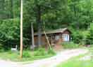
 One morning, we had breakfast in Warrensburg, already mentioned as the
boyhood home of Floyd Bennett. We were on our way northwest to the Natural
Stone Bridge and Caves.
One morning, we had breakfast in Warrensburg, already mentioned as the
boyhood home of Floyd Bennett. We were on our way northwest to the Natural
Stone Bridge and Caves.

 The trail head at the Stone Bridge is a little over-decorated. There's an
area for kids, where they can rinse dirt in a sluice to look for gems. It's
guarded by a mannequin called Silas Miner, with no apology to George
Eliot. They also display some minerals that were definitely not found here,
including a one-ton geode from Brazil and a petrified log whose origin was
not identified.
The trail head at the Stone Bridge is a little over-decorated. There's an
area for kids, where they can rinse dirt in a sluice to look for gems. It's
guarded by a mannequin called Silas Miner, with no apology to George
Eliot. They also display some minerals that were definitely not found here,
including a one-ton geode from Brazil and a petrified log whose origin was
not identified.
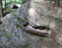 Trees grow from cracks in the rocks here. This one has a root that is useful
as a hand-grip on one of the steeper parts of the trail.
Trees grow from cracks in the rocks here. This one has a root that is useful
as a hand-grip on one of the steeper parts of the trail.
 There are a few waterfalls near the Stone Bridge. There's a larger version
of this picture
here.
There are a few waterfalls near the Stone Bridge. There's a larger version
of this picture
here.
 This cave has a small waterfall inside. It's called Noisy Cave for good
reason.
This cave has a small waterfall inside. It's called Noisy Cave for good
reason.
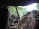
Noisy Cave, inside looking out.
 This window, Peter Pan's Peephole, gives another view of the stream in Noisy
Cave.
This window, Peter Pan's Peephole, gives another view of the stream in Noisy
Cave.
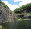
 This is the park's namesake, the Natural Stone Bridge. 180 feet wide, 62
feet high.
This is the park's namesake, the Natural Stone Bridge. 180 feet wide, 62
feet high.

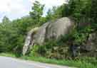
This formation might look like George Washington, facing right.
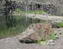
 There are potholes here, too. We saw potholes on
another trip,
two years ago — in the very different environment of the
southeast Utah desert.
There are potholes here, too. We saw potholes on
another trip,
two years ago — in the very different environment of the
southeast Utah desert.
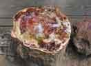
A short walk down the river takes us to a formation called the Oyster Shell (third photo, at right). There's a larger photo of the Oyster Shell here.


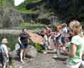 From the Stone Bridge, we went to North River to visit the Barton Garnet
Mine. This is the world's largest garnet mine. If you have ever used garnet
sandpaper, you've used Barton garnet. After we followed her down into the
mine, our guide gave a brief lecture about its history, and told us what to
look for.
From the Stone Bridge, we went to North River to visit the Barton Garnet
Mine. This is the world's largest garnet mine. If you have ever used garnet
sandpaper, you've used Barton garnet. After we followed her down into the
mine, our guide gave a brief lecture about its history, and told us what to
look for.
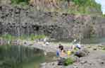
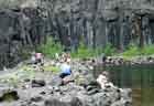 Then we had about half an hour to gather samples.
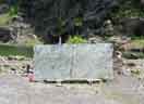 This finished slab would make an impressive table top for a very large
conference room.
This finished slab would make an impressive table top for a very large
conference room.
We didn't take anything nearly so large as these boulders. Ours were fist-size or smaller.


 Two views from inside the mine.
 Here are two of the more unusual houses we saw on the way to and from the
garnet mine. The first one caught my eye because of the "sculpture" in the
front yard. It was directly across the road from a beautiful stretch of the
Hudson River.
Here are two of the more unusual houses we saw on the way to and from the
garnet mine. The first one caught my eye because of the "sculpture" in the
front yard. It was directly across the road from a beautiful stretch of the
Hudson River.
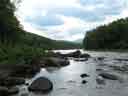
 In this part of the state, the Hudson River looks quite different from our
usual view of it.
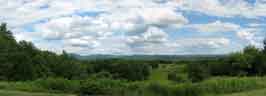
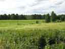
This area is in the heart of Adirondack Park. Comprising six million acres,
the park contains the largest wilderness area in the eastern United States.
It is nearly three times the size of Yellowstone. As a state park, it is
unique in its mix of land ownership. Nearly half is state-owned forest
preserve, and the remainder is mostly private. It is home to approximately
130,000 people. The major components of the park's economy are tourism,
forestry, agriculture, and mining.
In this part of the state, the Hudson River looks quite different from our
usual view of it.
This area is in the heart of Adirondack Park. Comprising six million acres,
the park contains the largest wilderness area in the eastern United States.
It is nearly three times the size of Yellowstone. As a state park, it is
unique in its mix of land ownership. Nearly half is state-owned forest
preserve, and the remainder is mostly private. It is home to approximately
130,000 people. The major components of the park's economy are tourism,
forestry, agriculture, and mining.
We spent Wednesday at the airport, partly as volunteers to help measure the distances for the spot landing contest. After we got the landing zone set up and marked off, we joined the briefings by Ron Levy, Walt Porter, and Ronnie Mowery.

 The planes took off in groups of four. Three circuits each —
two passes for flour bombing, then a full stop at the spot landing mark.
Well, in the vicinity of the spot landing mark.
The planes took off in groups of four. Three circuits each —
two passes for flour bombing, then a full stop at the spot landing mark.
Well, in the vicinity of the spot landing mark.
Since we were judging landings, there wasn't much for us to do while the
contestants were taking off. Here are a few of them.

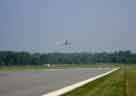 Both of these planes did land safely. Yes, there are two planes in this
picture. Find the landing light above and to the right of the larger image,
and you'll also find an airplane there.
Both of these planes did land safely. Yes, there are two planes in this
picture. Find the landing light above and to the right of the larger image,
and you'll also find an airplane there.
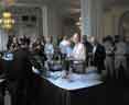
 We didn't have to wait long to learn the results. Lunch followed shortly
after the contests, ...
We didn't have to wait long to learn the results. Lunch followed shortly
after the contests, ...
 ... and presentation of the awards followed directly after lunch.
 Thomas Micke won the spot landing contest, having touched down only four feet
from the line.
Thomas Micke won the spot landing contest, having touched down only four feet
from the line.
 Doug Weir scored a grand slam. He won three awards for his Tiger:
Best 1970s, Best Avionics Suite, and Best in Show.
Doug Weir scored a grand slam. He won three awards for his Tiger:
Best 1970s, Best Avionics Suite, and Best in Show.
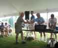
 Roscoe and Luann passed out the door prizes. Being in a tent, we had no
door, but that's just a technicality.
Roscoe and Luann passed out the door prizes. Being in a tent, we had no
door, but that's just a technicality.
 That evening, we enjoyed a dinner cruise aboard the Adirondac's sister
ship, Horicon.
That evening, we enjoyed a dinner cruise aboard the Adirondac's sister
ship, Horicon.
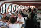
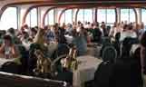 Dinner was prime rib and conversation. Both were excellent. Our cabin was
advertised as air-conditioned, but something wasn't working right. The crew
admonished us to close the windows, but it was much cooler outside than in.
It didn't take long before a quiet mutiny got fresh air circulating through
open windows.
Dinner was prime rib and conversation. Both were excellent. Our cabin was
advertised as air-conditioned, but something wasn't working right. The crew
admonished us to close the windows, but it was much cooler outside than in.
It didn't take long before a quiet mutiny got fresh air circulating through
open windows.
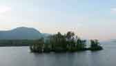
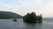
During and after our meal, we cruised among Lake George's 179 islands.
 Pilot Knob had been bought by a developer, who started building on top of it.
The resulting eyesore could be seen from almost anywhere on the southern end
of Lake George. After a while, a conservancy group acquired the property
and dismantled the development, leaving this bald promontory.
Pilot Knob had been bought by a developer, who started building on top of it.
The resulting eyesore could be seen from almost anywhere on the southern end
of Lake George. After a while, a conservancy group acquired the property
and dismantled the development, leaving this bald promontory.
 Even the chairmen got to relax a bit.
 We got another look at Minne-Ha-Ha.
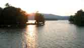
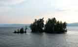
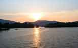
 Our cruise lasted almost until sunset. With the horizon below the hilltops,
we still had magnificent scenery at twilight.
Our cruise lasted almost until sunset. With the horizon below the hilltops,
we still had magnificent scenery at twilight.
When we got back, we found out who the harbormaster really is.
 We started one day in Bolton Landing, a quiet lakeside town about ten
miles north of Lake George Village.
We started one day in Bolton Landing, a quiet lakeside town about ten
miles north of Lake George Village.

 The Bolton Landing Veterans' Memorial is clearly modelled on Washington's
Vietnam Wall, but it honors local veterans of all American wars.
The Bolton Landing Veterans' Memorial is clearly modelled on Washington's
Vietnam Wall, but it honors local veterans of all American wars.
 Up Yonda Farm is an environmental center near Bolton Landing, a local essay
in ecotourism. It is also home to the fanciest bird feeder around. They have
a trail system that leads through the woods to the top of a hill, where the
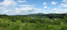
hiker is rewarded with a stunning view of
The Narrows of Lake George.
Up Yonda Farm is an environmental center near Bolton Landing, a local essay
in ecotourism. It is also home to the fanciest bird feeder around. They have
a trail system that leads through the woods to the top of a hill, where the
hiker is rewarded with a stunning view of
The Narrows of Lake George.
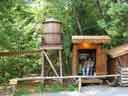
 They gather maple sap via plastic tubing, much of which
ends up at this sugar house.
They gather maple sap via plastic tubing, much of which
ends up at this sugar house.
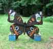 There's an enclosed butterfly house that doesn't really need such a prominent
marker. So far this year, there are not very many tenants. But they're
working on it.
There's an enclosed butterfly house that doesn't really need such a prominent
marker. So far this year, there are not very many tenants. But they're
working on it.


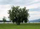
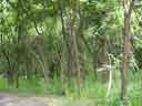
 Some of the trees we saw on the way up the hill.
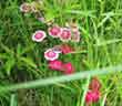

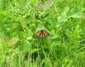
Even milkweed looks good up here.
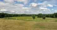
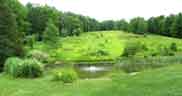 This was our view up the hill from the pond near the parking lot.
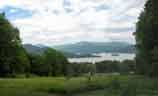 This is the same hill, viewed from the other end. It was worth the work to
get up there.
This is the same hill, viewed from the other end. It was worth the work to
get up there.

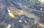 Driving north to Rogers Rock, we stopped for a while at a little frog pond.
 Roadside scene in the Town of Graphite. We saw this on the way back from
Rogers Rock.
Roadside scene in the Town of Graphite. We saw this on the way back from
Rogers Rock.
What an odd name for a town, Graphite. Samuel Ackerman discovered
graphite here while skidding logs.
The mines opened in 1887, closed in 1921.
There were two mines, one in Graphite and one in Hague. The
mines closed because it was more profitable to import graphite for four cents
a pound than to process it for seven cents a pound.
Bats soon discovered that the abandoned mines provided a perfect climate for
hibernation. Temperature stays above freezing, so the bats can find water
when they need it. All six species of bats that live in the Adirondacks
gather here each fall, making this the largest bat hibernacula in the
northeast.
Wonder what the elephant thinks about that.

 Rogers Rock, also known as Rogers' Slide, is a steep bluff nearly 800 feet
above Lake George. Robert Rogers distinguished himself in the
service of Britain during the French and Indian War. He is well remembered
as the founder of Rogers' Rangers, the same special forces now known as the
US Army Rangers.
Rogers Rock, also known as Rogers' Slide, is a steep bluff nearly 800 feet
above Lake George. Robert Rogers distinguished himself in the
service of Britain during the French and Indian War. He is well remembered
as the founder of Rogers' Rangers, the same special forces now known as the
US Army Rangers.
In March 1758, Major Rogers left Ft. Edward for Lake George with a small army. He intended to go around this rock and surprise the French, who held Ft. Carillon (Ticonderoga). The French found out he was coming and ambushed him, killing most of his company. Rogers escaped unharmed, and climbed the mountain on snowshoes until he reached its steep eastern drop-off.
Thinking quickly, Rogers threw his knapsack and haversack down the cliff. Then, without moving his snowshoes, he turned around on them and re-tied them so his toes were facing the snowshoes' tails. He walked back down the hill next to his earlier tracks, leaving the appearance that two men had walked up to the bluff and no farther.
By the time the Indians — who had been following his tracks — reached the cliff, Rogers had reached his belongings on the lake, strapped them on, and was seen striding off toward Ft. William Henry. The Indians jumped to the conclusion that Rogers had jumped over the cliff unharmed. Believing that he must have been helped by the Good Spirit, they took this "miracle" as a sign that he was not to be molested, and broke off the chase.
Historians generally agree that the Battle of Saratoga is among the ten most important battles in the history of the world. This victory encouraged other European nations to take up arms against the English, ultimately securing the independence of the American States. Because Saratoga National Historical Park is so close to Glens Falls, I couldn't pass up a side trip.
 Today's peaceful view of the battlefield from the park's visitor center gives
lie to the events that happened there in September and October, 1777.
Today's peaceful view of the battlefield from the park's visitor center gives
lie to the events that happened there in September and October, 1777.
 A nine-mile tour road lets the visitor see the main battle sites from the
soldiers' perspective.
A nine-mile tour road lets the visitor see the main battle sites from the
soldiers' perspective.
 British Gen. John Burgoyne believed firmly in the importance of the
Hudson River. Attempting to cut off the fractious New Englanders from the
rest of the rebel colonies, he devised a three-pronged attack. He would
capture the Hudson Valley in a march south from Canada. Col. Barry
St. Leger would march east from Lake Ontario through the Mohawk Valley.
Finally, Sir William Howe would march north along the Hudson from New York
City, recently captured from the Americans. Burgoyne left St. Jean (near
Québec) in June 1777 with a force of 9000. These included British
regulars, German mercenaries from Brunswick and Hesse-Hanau, loyalists,
Indians, and camp followers.
British Gen. John Burgoyne believed firmly in the importance of the
Hudson River. Attempting to cut off the fractious New Englanders from the
rest of the rebel colonies, he devised a three-pronged attack. He would
capture the Hudson Valley in a march south from Canada. Col. Barry
St. Leger would march east from Lake Ontario through the Mohawk Valley.
Finally, Sir William Howe would march north along the Hudson from New York
City, recently captured from the Americans. Burgoyne left St. Jean (near
Québec) in June 1777 with a force of 9000. These included British
regulars, German mercenaries from Brunswick and Hesse-Hanau, loyalists,
Indians, and camp followers.
Burgoyne took his first objective, defeating Gen. Philip Schuyler at Ft. Ticonderoga in July after a four-day siege. In his southward retreat, Schuyler covered his path with impediments that drastically slowed the British advance.
Burgoyne pressed on, reaching Saratoga (now called Schuylerville) on 13 September. He soon arrived near the American fortifications at Bemis Heights.
 John and Lydia Neilson had a farm just below Bemis Heights. When war came,
Lydia went to live with relatives and John Neilson joined the American troops
against Gen. Burgoyne. By mid-September 1777, General Gates had taken
over the house and barn, using it for his headquarters.
John and Lydia Neilson had a farm just below Bemis Heights. When war came,
Lydia went to live with relatives and John Neilson joined the American troops
against Gen. Burgoyne. By mid-September 1777, General Gates had taken
over the house and barn, using it for his headquarters.
 This house is a reproduction, of course. The visitor can see how the house
was used.
This house is a reproduction, of course. The visitor can see how the house
was used.
 Here, as throughout the park, the American and British fortifications are
marked by wood posts.
Here, as throughout the park, the American and British fortifications are
marked by wood posts.
 Bemis Heights, across the road from the reconstructed farm house, is still a
very imposing hill.
History changes fast, but geology has a very slow clock in human terms.
Bemis Heights, across the road from the reconstructed farm house, is still a
very imposing hill.
History changes fast, but geology has a very slow clock in human terms.
The fortification at Bemis Heights was designed by Philip Schuyler before the Continental Congress relieved him of command because of his defeat at Ticonderoga. He had sent Col. Tadeusz Kosciuszko and Gen. Benedict Arnold to prepare this area. This strong position was on one side of the road to Albany; the Hudson River was on the other.
 The British had to either
run the gauntlet between the Heights and the river, risking catastrophe; or
drive the Americans out of Bemis Heights. Burgoyne chose to fight.
The British had to either
run the gauntlet between the Heights and the river, risking catastrophe; or
drive the Americans out of Bemis Heights. Burgoyne chose to fight.
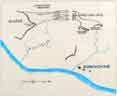
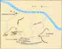
John Freeman was a loyalist who had gone north to join the British invading force. The first shots of the Battle of Saratoga were fired on his farm. A sign near this overlook shows how things shaped up in the first of two battles that are collectively called the Battle of Saratoga. Except for the farm itself, most of the terrain was forested; this is where the British soldiers marched while the Americans waited.
On 19 September the British advanced in three columns: Burgoyne and Fraser through the woods, and von Riedesel's troops along the river road. Col. Daniel Morgan was the first to meet the advance. His army of Virginia and Pennsylvania riflemen opened fire on Burgoyne's center column at the Freeman farm. The Americans outnumbered the invaders, and might have won the battle that day except for von Riedesel's timely arrival. With this help, Burgoyne eventually forced the Americans to withdraw. He dug in near the Freeman farm and waited for reinforcements.
 The park's visitor center has a diorama that depicts Morgan's riflemen
regrouping in the woods during the opening battle.
The park's visitor center has a diorama that depicts Morgan's riflemen
regrouping in the woods during the opening battle.
Burgoyne wanted to fight again the next day (20 September), but Gen. Simon Fraser persuaded him to rest a day. Then he learned that Gen. Clinton was on his way north from New York City. Believing that he would soon have the Americans surrounded, Burgoyne started constructing defensive fortifications: the Balcarres Redoubt at the Freeman farm, and the Breymann Redoubt nearby. The next scenes are from the Breymann Redoubt.

 Burgoyne also fortified some bluffs overlooking the river, to guard his
hospital, the Indian camp, and a supply line on the river.
Burgoyne also fortified some bluffs overlooking the river, to guard his
hospital, the Indian camp, and a supply line on the river.
There is a slightly larger version of this scene
here.
 Burgoyne made his headquarters near a spring
between his river fortifications and the
Balcarres Redoubt. The group in this photo includes two Englishmen and two
Germans.
Burgoyne made his headquarters near a spring
between his river fortifications and the
Balcarres Redoubt. The group in this photo includes two Englishmen and two
Germans.
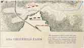 Asa Chatfield's farm is about midway between the American forces at Bemis
Heights, and the British at their redoubts near the Freeman farm.
Asa Chatfield's farm is about midway between the American forces at Bemis
Heights, and the British at their redoubts near the Freeman farm.
 With his supplies running low and his army becoming weaker every day,
Burgoyne finally decided he could wait no longer for Clinton's army to
arrive. (They weren't coming anyway, but Burgoyne didn't know that.)
On 7 October, he ordered a reconnaissance-in-force to test the American
left flank. These men deployed in a wheat field on the Barber farm. The
Americans found out what was going on, and attacked in three columns under
Col. Morgan, Gen. Ebenezer Learned, and Gen. Enoch Poor. The
battle was on.
With his supplies running low and his army becoming weaker every day,
Burgoyne finally decided he could wait no longer for Clinton's army to
arrive. (They weren't coming anyway, but Burgoyne didn't know that.)
On 7 October, he ordered a reconnaissance-in-force to test the American
left flank. These men deployed in a wheat field on the Barber farm. The
Americans found out what was going on, and attacked in three columns under
Col. Morgan, Gen. Ebenezer Learned, and Gen. Enoch Poor. The
battle was on.

 Within minutes, more than 4000 men collided in savage combat along a line
stretching westward across the Barber Wheat Field to the clearing on the far
hillside.
Within minutes, more than 4000 men collided in savage combat along a line
stretching westward across the Barber Wheat Field to the clearing on the far
hillside.
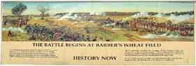
There is a larger, more readable, version of the panorama here.
 Again and again, the British line was broken and rallied. Both flanks were
pounded. Gen. Simon Fraser, who commanded the British right flank, was
mortally wounded while riding among his men to encourage them. Benedict
Arnold had been relieved of his command after an earlier quarrel with
Gen. Gates. Now he rode onto the field and led Learned's brigade
against the Hessian troops holding the British center. The Germans joined a
general withdrawal to safer ground on the Freeman farm.
Again and again, the British line was broken and rallied. Both flanks were
pounded. Gen. Simon Fraser, who commanded the British right flank, was
mortally wounded while riding among his men to encourage them. Benedict
Arnold had been relieved of his command after an earlier quarrel with
Gen. Gates. Now he rode onto the field and led Learned's brigade
against the Hessian troops holding the British center. The Germans joined a
general withdrawal to safer ground on the Freeman farm.
Arnold then led the Americans in a series of punishing attacks on the Balcarres Redoubt. Failing to achieve his objective at first, he wheeled his horse and ran through the crossfire to the Breymann Redoubt. There he joined in the final stage of an ongoing attack, overwhelming the German soldiers there. When he entered the redoubt, he was wounded in the leg. If he had not survived this battle, there is no doubt he would be remembered as one of the main heroes of the American Revolution.
 Another diorama at the visitor center shows Benedict Arnold leading the
attack on the Breymann Redoubt.
Another diorama at the visitor center shows Benedict Arnold leading the
attack on the Breymann Redoubt.
 This monument to Benedict Arnold honors him but does not mention his name.
Although he might have been the hero of the battle that turned the tide of
the American Revolution, he later became the prototype Disgruntled Employee.
Believing he was not properly rewarded for his heroism, he contracted
with the British to sell them West Point and George Washington. He
eventually became a Brigadier General in the British Army. Needless to say,
he is not remembered as an American hero. When Arnold was leading the
British in Virginia, it is reported that he asked an American prisoner what
the Americans would do if they caught him. The American replied,
"They will cut off the leg which was wounded when you were fighting so
gloriously for the cause of liberty, and bury it with the honors of war, and
hang the rest of your body on a gibbet!"
This monument to Benedict Arnold honors him but does not mention his name.
Although he might have been the hero of the battle that turned the tide of
the American Revolution, he later became the prototype Disgruntled Employee.
Believing he was not properly rewarded for his heroism, he contracted
with the British to sell them West Point and George Washington. He
eventually became a Brigadier General in the British Army. Needless to say,
he is not remembered as an American hero. When Arnold was leading the
British in Virginia, it is reported that he asked an American prisoner what
the Americans would do if they caught him. The American replied,
"They will cut off the leg which was wounded when you were fighting so
gloriously for the cause of liberty, and bury it with the honors of war, and
hang the rest of your body on a gibbet!"
Erected 1887 By
JOHN WATTS de PEYSTER
Brev. Maj. Gen. S.N.Y.
2nd V. Pres't Saratoga Mon't Ass't'n.
In memory of
the most brilliant soldier of the
Continental Army
who was desperately wounded
on this spot the sally port of
BURGOYNE'S GREAT WESTERN REDOUBT
7th October 1777
winning for his countrymen
the decisive battle of the
American Revolution
and for himself the rank of
Major General
 General Fraser was buried near the British river redoubts. There is also a
monument at the site where he was wounded, but the writing on it is
illegible.
General Fraser was buried near the British river redoubts. There is also a
monument at the site where he was wounded, but the writing on it is
illegible.
 The onset of darkness saved Burgoyne's army from immediate disaster. Leaving
his campfires burning, he withdrew his troops behind the Great Redoubt
overlooking the river. The next night, after burying Gen. Fraser, the
British began their retreat northward.
The onset of darkness saved Burgoyne's army from immediate disaster. Leaving
his campfires burning, he withdrew his troops behind the Great Redoubt
overlooking the river. The next night, after burying Gen. Fraser, the
British began their retreat northward.
At Saratoga (Schuylerville), Burgoyne's army was surrounded by the Americans. After a week of siege, he surrendered on 17 October, by the terms of the Convention of Saratoga.
 The Saratoga Monument, commemorating Burgoyne's surrender to Gates, is on the
spot where that meeting occurred. The cornerstone was laid on
17 October 1877, exactly one hundred years after the surrender. The
monument was finished five years later. Visitors may climb the 184 steps
(155 feet) to the view from its top. For the less ambitious, there are also
good views part-way up, above the statues.
The Saratoga Monument, commemorating Burgoyne's surrender to Gates, is on the
spot where that meeting occurred. The cornerstone was laid on
17 October 1877, exactly one hundred years after the surrender. The
monument was finished five years later. Visitors may climb the 184 steps
(155 feet) to the view from its top. For the less ambitious, there are also
good views part-way up, above the statues.
There are four niches around the monument, with life-size statues in three of
them:
Col. Daniel Morgan faces west, where he took position to surround the
British.
Gen. Horatio Gates faces north, toward the British invaders.
Gen. Philip Schuyler faces east, toward his home next to the Hudson River.
The south niche, facing the battlefield, is empty. It represents Benedict
Arnold.


Jared Clark Markham, 1885
There are sixteen bronze bas-reliefs on the walls of the first two levels inside the monument, depicting scenes from the battles. These three are the fall of Gen. Fraser, Gen. Burgoyne reprimanding the Indians for their barbarities, and the surrender.
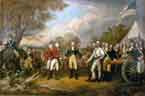 This painting is not at Saratoga. It is John Trumbull's The Surrender of
General Burgoyne at Saratoga, one of eight murals in the U.S. Capitol
rotunda in Washington DC. Trumbull painted four of those murals. In the
painting, Burgoyne is seen offering his sword in surrender to
Gen. Gates, who immediately returned it to him. Then, treating the
other man as an officer and gentleman, Gates invited Burgoyne into his tent.
All of the figures in the painting are likenesses of officers who met at the
Convention of Saratoga.
This painting is not at Saratoga. It is John Trumbull's The Surrender of
General Burgoyne at Saratoga, one of eight murals in the U.S. Capitol
rotunda in Washington DC. Trumbull painted four of those murals. In the
painting, Burgoyne is seen offering his sword in surrender to
Gen. Gates, who immediately returned it to him. Then, treating the
other man as an officer and gentleman, Gates invited Burgoyne into his tent.
All of the figures in the painting are likenesses of officers who met at the
Convention of Saratoga.
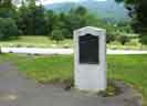
 The Daughters of the American Revolution placed this monument near the
Neilson farm in 1951.
The Daughters of the American Revolution placed this monument near the
Neilson farm in 1951.
The unknown American soldiers
who perished in the Battles of Saratoga
September 19 and October 7, 1777
and were here buried in unmarked graves
helped to assure the triumph of the War of Independence
to create the Republic of the United States of America
and to establish liberty throughout the world
All of that happened in this serene place.
 The visitor center has examples of weapons in use in the late 18th Century.
These three pieces are English: a short saber, an officer's spontoon (pike),
and a holster pistol.
The visitor center has examples of weapons in use in the late 18th Century.
These three pieces are English: a short saber, an officer's spontoon (pike),
and a holster pistol.
 The long guns are an American musket; French "Model 1768" (modified Model
1766) infantry musket; and a British Pattern 1768 short land service musket.
The gadget at upper right is an artillery worm head. It's used to clean the
bore of larger guns than the ones in this cabinet.
The long guns are an American musket; French "Model 1768" (modified Model
1766) infantry musket; and a British Pattern 1768 short land service musket.
The gadget at upper right is an artillery worm head. It's used to clean the
bore of larger guns than the ones in this cabinet.
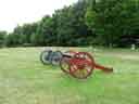
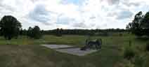
 These 2000-pound British cannons fired on American soldiers at the Battle of
Saratoga. They were among the arms surrendered at the battlefield. With
other surrendered weapons, they were later turned against British forces.
They were almost used as scrap metal during World War II.
These 2000-pound British cannons fired on American soldiers at the Battle of
Saratoga. They were among the arms surrendered at the battlefield. With
other surrendered weapons, they were later turned against British forces.
They were almost used as scrap metal during World War II.
Generals Philip Schuyler and Horatio Gates were political competitors for the command of the Northern Department of the American Army. In early 1777, Schuyler had the upper hand. But he made some tactical mistakes that led to the fall of Ft. Ticonderoga in July of that year. He retreated to Saratoga, where he designed a plan to engage the British in battle.
As they retreated, the Americans placed several obstacles in the way of their enemy. They felled trees, and burned bridges and crops. The British had planned their march down the Hudson for summer, counting on being able to seize those crops for provisions. This slash-and-burn strategy, suggested by Schuyler's wife Catherine, slowed the British advance to a crawl, and reduced their situation to near starvation by the time they fought the Americans at Saratoga.
Schuyler dispatched Col. Tadeusz Kosciuszko — an engineer as well as a soldier — and Benedict Arnold to Saratoga, to prepare a defensive position at Bemis Heights. Although he had the situation under control, Schuyler had fallen out of favor, and the Continental Congress sent Gen. Gates to assume command.
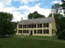 Gen. Schuyler had a home in Albany, and a summer home on this spot at
present-day Schuylerville. This is the third house. The
first, belonging to Capt. Philip Schuyler, was burned by French and
Indians in 1745. The first Schuyler was killed in that raid. The second
house was burned by the British as they retreated after the Battle of
Saratoga in 1777. Schuyler set about
rebuilding immediately, completing this house in November 1777.
The house is open in summer for guided tours.
Gen. Schuyler had a home in Albany, and a summer home on this spot at
present-day Schuylerville. This is the third house. The
first, belonging to Capt. Philip Schuyler, was burned by French and
Indians in 1745. The first Schuyler was killed in that raid. The second
house was burned by the British as they retreated after the Battle of
Saratoga in 1777. Schuyler set about
rebuilding immediately, completing this house in November 1777.
The house is open in summer for guided tours.
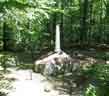
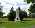
 There is a memorial to Kosciuszko, too — back in the park near the
Neilson farm.
There is a memorial to Kosciuszko, too — back in the park near the
Neilson farm.
1746–1817
In memory of
The Noble Son of Poland
Brig. General
Thaddeus Kosciuszko
Military Engineer
Soldier of the War of Independence
Who under command of General Gates selected and fortified these
fields for the great Battle of Saratoga in which the invader was
vanquished and American freedom assured
Erected by his compatriots AD 1936
On the other side, it says, in Polish:
This monument was erected by Poles from
Albany, Amsterdam, Cohoes, Schenectady, Troy, Watervliet, and surrounds,
1936
 We started the last convention day back at the airport, where the ground
events were still happening. We were a little too late for the adult
contestants at Map Folding, but the kids were still having a ball.
We started the last convention day back at the airport, where the ground
events were still happening. We were a little too late for the adult
contestants at Map Folding, but the kids were still having a ball.
The contestants must fold a sectional chart in the face of some "standard"
adversities of a Grumman cockpit: wind, rain, turbulence, shouting panicking
co-pilots, bubbles, badminton shuttles (bird strikes?) ...
just about anything goes.
 For the precision taxi event, the pilot follows a serpentine course where
there are several eggs to be crushed by the nosewheel. There were a lot of
undamaged eggs left over. Here, Matt Drahzal almost got one.
Almost.
For the precision taxi event, the pilot follows a serpentine course where
there are several eggs to be crushed by the nosewheel. There were a lot of
undamaged eggs left over. Here, Matt Drahzal almost got one.
Almost.
 This airplane has about thirty problems that were imposed by the judges for
contestants to find. Ashley Porter did a very thorough walk-around and found
several things that would prevent her from flying before they were fixed. Her
father, Walt, really threw himself into it.
This airplane has about thirty problems that were imposed by the judges for
contestants to find. Ashley Porter did a very thorough walk-around and found
several things that would prevent her from flying before they were fixed. Her
father, Walt, really threw himself into it.
This is the Broken Towbar contest, the only event with separate prizes for
men and women. The entrants act out the problems that a Grumman pilot would
have if she had to push one of our planes around without the benefit of a
towbar for directional control.
 Although it had cooled off a bit, most of the pilots still preferred to take
in the scene from a shady vantage point.
Although it had cooled off a bit, most of the pilots still preferred to take
in the scene from a shady vantage point.
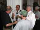
 In the evening, we got together for the farewell banquet. First, the cocktail
hour.
In the evening, we got together for the farewell banquet. First, the cocktail
hour.


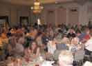
 We enjoyed the Hotel Queensbury's finest fare and each others' company for a
while, and then our President, Nigel Thomas, made a few remarks by way of
introduction and recognizing several people for their outstanding efforts
both public and private.
We enjoyed the Hotel Queensbury's finest fare and each others' company for a
while, and then our President, Nigel Thomas, made a few remarks by way of
introduction and recognizing several people for their outstanding efforts
both public and private.
 Some awards were earned in competition. Christine Micke was the fastest to
push a two-seat Grumman backward in the women's competition. She's receiving
her award from Arnie Sperfslage, who will chair next year's convention in
Burlington, Iowa.
Some awards were earned in competition. Christine Micke was the fastest to
push a two-seat Grumman backward in the women's competition. She's receiving
her award from Arnie Sperfslage, who will chair next year's convention in
Burlington, Iowa.
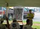
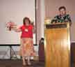 Geoff Hickey explained the rules for the Aerial Scavenger Hunt. One of the
requested items was a model airplane made entirely of beer cans.
There were extra points awarded if the plane had a sliding canopy.
Leslie Maloof displays two of those entries.
Geoff Hickey explained the rules for the Aerial Scavenger Hunt. One of the
requested items was a model airplane made entirely of beer cans.
There were extra points awarded if the plane had a sliding canopy.
Leslie Maloof displays two of those entries.


Rob Jones, Jeff Simon, John Klapp, Gene Ledda.
 Roscoe and Luann recognize some of the Star Squad (youth brigade):
"TJ" Jackson, Ryan Willome, and Kim Schmitz.
Roscoe and Luann recognize some of the Star Squad (youth brigade):
"TJ" Jackson, Ryan Willome, and Kim Schmitz.

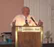
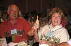
 Ron Levy received the coveted Lauren Larsen Award for outstanding dedication
and service to the American Yankee Association. For a change, Ron was
speechless.
Ron Levy received the coveted Lauren Larsen Award for outstanding dedication
and service to the American Yankee Association. For a change, Ron was
speechless.

After flightseeing the States for another week, our European guests finally
got back to Connecticut. One more riverfront dinner, and we said our
convention good-byes.


 Now, what about those chickens? Ni Thomas's faithful travelling companion
is well known to all. This year, she acquired a companion of her own.
Considering what happened next, she also must have had some special
surgery.
Now, what about those chickens? Ni Thomas's faithful travelling companion
is well known to all. This year, she acquired a companion of her own.
Considering what happened next, she also must have had some special
surgery.
Ni always locked his room, so outside interference can be ruled out. Those
eggs that appeared on his pillow every night could only have been produced by
the two birds shown here. Being of an advanced species, the eggs had hatched
by the last night of the convention, and Ni showed up with half a dozen baby
rubber chicks in tow. He distributed these around the room to several
delighted adoptive parents. I suppose we'll see them as adults next year at
Burlington. Maybe some will have rubber families of their own by then.
Until then, we'll just savor this year's Adirondack trip.