There are almost 300 photos here, so even the small version will take several seconds to load. Please be patient.
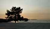
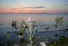
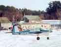 This is the story of our trip to Cody, Wyoming, for the American Yankee
Association's 2002 fly-in convention. Our conveyance was N9413L, a 1971
American Trainer ("Yankee") with a stock 108-HP engine. This plane has
carried us to plenty of other interesting places, including the ice runway at
Lake Winnipesaukee (pictured) and the 2000 AYA convention at Laconia. It's no
speed star, but it is an honest little airplane that gets the job done.
This is the story of our trip to Cody, Wyoming, for the American Yankee
Association's 2002 fly-in convention. Our conveyance was N9413L, a 1971
American Trainer ("Yankee") with a stock 108-HP engine. This plane has
carried us to plenty of other interesting places, including the ice runway at
Lake Winnipesaukee (pictured) and the 2000 AYA convention at Laconia. It's no
speed star, but it is an honest little airplane that gets the job done.
We spent quite a bit of time planning this trip, intending to see several interesting places and do many things along the way from Connecticut to Cody. Following the formula of some previous trips, we made a list of more things than we could possibly do. The idea was that when the time came, we would fly to those places that had good weather. On this trip, we got lucky beyond imagination.
Although I had planned for IFR routes (and bought tons of charts that were never used), we made the entire trip under VFR. Legally. Didn't fly through a single cloud the whole time.
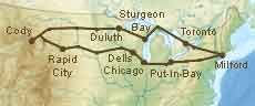 We visited these airports:
Franklin, Penna. - fuel
Put-in-Bay, Ohio - overnight
Bowling Green, Ohio - fuel
Chicago, Ill. - overnight
Wisconsin Dells, Wis. - overnight
Winona, Minn. - fuel
Sioux Falls, S.D. - fuel
Pierre, S.D. - fuel
Rapid City, S.D. - overnight
Sheridan, Wyo. - fuel
Cody, Wyo. - the convention site
Miles City, Mont. - fuel
Bismarck, N.D. - fuel
Moorhead, Minn. (Fargo) - fuel
Duluth, Minn. - overnight
Sturgeon Bay, Wis. - overnight
Sault Ste. Marie, Ont. - fuel and Customs
Toronto Island, Ont. - overnight
Rochester, N.Y. - fuel and Customs
Milford, Conn. - home
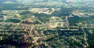 Medina, Ohio. There are several housing developments that are new enough to
have no trees, so the white sidewalks really stand out.
Medina, Ohio. There are several housing developments that are new enough to
have no trees, so the white sidewalks really stand out.

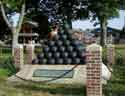
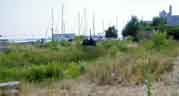
 Our first overnight stop was
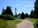
Put-in-Bay, Ohio. This town is on South Bass
Island in Lake Erie, near Sandusky. It was Commodore Oliver Hazard Perry's
headquarters in the War of 1812, where he fought and won the Battle of Lake
Erie in 1813. This battle eventually led to the Treaty of Ghent, the world's
first negotiated peace by disarmament. As a result of this treaty, which is
still in force, the U.S. and Canada share the world's longest unsecured
border. This monument commemorates that peace. 352 feet high, it's the
nation's third-highest national monument - after the Washington Monument and
the Gateway Arch in St. Louis.
Our first overnight stop was
Put-in-Bay, Ohio. This town is on South Bass
Island in Lake Erie, near Sandusky. It was Commodore Oliver Hazard Perry's
headquarters in the War of 1812, where he fought and won the Battle of Lake
Erie in 1813. This battle eventually led to the Treaty of Ghent, the world's
first negotiated peace by disarmament. As a result of this treaty, which is
still in force, the U.S. and Canada share the world's longest unsecured
border. This monument commemorates that peace. 352 feet high, it's the
nation's third-highest national monument - after the Washington Monument and
the Gateway Arch in St. Louis.
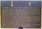
In May 2002 the Park Service inaugurated the interpretive center near the monument, featuring the statue of Perry that is on permanent loan from the city of Perryville, Ohio.
This was one of two places in the U.S. where we saw the U.S. and Canadian flags flying together at equal height - the Perry Monument is designated an International Monument. (The other place was an FBO in Bismarck.)
 The inscription on the plaque says it best:
Within this enclosure reposed for a century the remains of three American and
three British officers killed in the Battle of Lake Erie, September 10th,
1813. They were disinterred September 11th, 1913, and re-interred in the
crypt of Perry Memorial with international ceremonies conducted by the
Commissioners of the Perry's Victory Centennial.
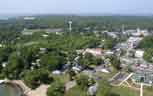
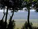
 These are views from the top of the monument, looking south. In the first
picture, the interpretive center is at lower right and the airport is at upper
left. The monument's observation deck gives a good view of all the nearby
islands; including Pelee, which is the southernmost point in Canada.
At the lower left in the first photo is the area they call "bathing beach."
Get it straight: if you're from either coast, Put-in-Bay has
no beaches. The
best way to swim here is from a boat. That's exactly what most people seem
to do.
These are views from the top of the monument, looking south. In the first
picture, the interpretive center is at lower right and the airport is at upper
left. The monument's observation deck gives a good view of all the nearby
islands; including Pelee, which is the southernmost point in Canada.
At the lower left in the first photo is the area they call "bathing beach."
Get it straight: if you're from either coast, Put-in-Bay has
no beaches. The
best way to swim here is from a boat. That's exactly what most people seem
to do.
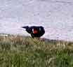 Red-winged blackbirds are common on South Bass Island, especially around the
Perry Monument.
Red-winged blackbirds are common on South Bass Island, especially around the
Perry Monument.
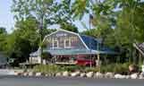
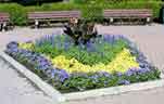
 Here is the local hardware store, and the garden along its front fence. The
town was decorated for Independence Day.
Here is the local hardware store, and the garden along its front fence. The
town was decorated for Independence Day.

Look closely at this picture of that fence.
There's a fledgling bird behind the blue
flower near the center of the picture.
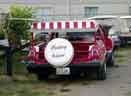
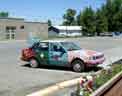
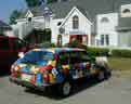 A couple of noteworthy cars. Notice the golf carts in one shot. Golf carts
are more commonly used to get around the island, than cars. Don't miss the
license tag on the red car.
A couple of noteworthy cars. Notice the golf carts in one shot. Golf carts
are more commonly used to get around the island, than cars. Don't miss the
license tag on the red car.
Street scenes, Put-in-Bay. It's easy to see the ratio of golf carts to cars. These were taken before 10 AM, so there are not too many people out yet.
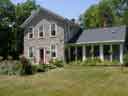
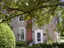
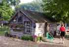
Stonehenge. Built of sandstone about 1855, the walls are one foot thick. The wine cellar is the coolest place in town.

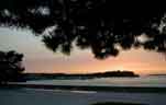
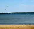
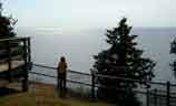
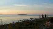
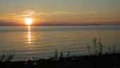
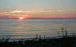
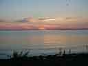
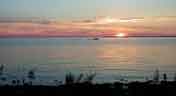
Sunset on Lake Erie.
Next, we went to Chicago, where we saw fireworks set to live symphonic music - along with about 1.5 million other people in Grant Park. No pictures, because I don't generally get very good pictures of crowds or fireworks. It was hot. As we tried to decide where to go next, the weather map made that choice easy. There was only one part of the country where the daily highs were below 90, so we went there...
 Wisconsin Dells. The amusement park capital of the Midwest.
More waterslides per capita than practically any other place in the world.
Wisconsin Dells. The amusement park capital of the Midwest.
More waterslides per capita than practically any other place in the world.

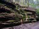
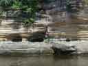 "Dells" is an anglicized version of a French word that describes the
characteristic rock formations in the area. The same word is also found in
Oregon's Dalles and Texas's Dallas. It's a stratified sandstone that is
interesting geologically, and also very nice to look at.
"Dells" is an anglicized version of a French word that describes the
characteristic rock formations in the area. The same word is also found in
Oregon's Dalles and Texas's Dallas. It's a stratified sandstone that is
interesting geologically, and also very nice to look at.


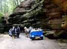
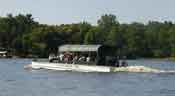 We started our tour of the Dells with a ride on the
Ducks. Ducks are
reconditioned
We started our tour of the Dells with a ride on the
Ducks. Ducks are
reconditioned

 The tour guide is fond of pointing out the special rock formations. They've
made up stories about some of them, like the grand piano that fell on its
side. Others, like the eagle, are simply there for the viewing.
The tour guide is fond of pointing out the special rock formations. They've
made up stories about some of them, like the grand piano that fell on its
side. Others, like the eagle, are simply there for the viewing.
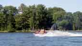 The Duck tour ended on Lake Delton, where we saw the first of many spitting
boats.
The Duck tour ended on Lake Delton, where we saw the first of many spitting
boats.
 Next morning we got onto a more conventional boat for a
tour of the Upper
Dells, a different part of the Wisconsin River. Here is the entrance, called
the Jaws of the Dells.
Next morning we got onto a more conventional boat for a
tour of the Upper
Dells, a different part of the Wisconsin River. Here is the entrance, called
the Jaws of the Dells.
This is what the Wisconsin Dells are about - rocks.


 Almost all of the Dells are on state park land. There are two private resorts
on the river, which is how these people got mixed up in the geology. The rest
is all natural, and will not be developed.
Almost all of the Dells are on state park land. There are two private resorts
on the river, which is how these people got mixed up in the geology. The rest
is all natural, and will not be developed.
 The boat stopped twice and we took short walks into the woods on
prepared trails. The first stop included natural formations like the
Witches' Bathtub and the Witches' Window. These formations are part of a
story about witches that supposedly haunt this part of the woods.
The boat stopped twice and we took short walks into the woods on
prepared trails. The first stop included natural formations like the
Witches' Bathtub and the Witches' Window. These formations are part of a
story about witches that supposedly haunt this part of the woods.
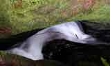 A stream rushes through the Witches' Bathtub about 12 feet down from the
walk, where it makes a noise like thunder, but with a hollow sound.
A stream rushes through the Witches' Bathtub about 12 feet down from the
walk, where it makes a noise like thunder, but with a hollow sound.
 The Witches' Window is a natural opening in the rock.
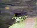
 Graffiti must be among the oldest of human art forms. This carving was left
in the sandstone by
Graffiti must be among the oldest of human art forms. This carving was left
in the sandstone by
 Then we got back on the boat, as far as Stand Rock. Just before we got
there, we saw a tepee high on a hill. Nobody would actually want to live
there, but you can never escape the fact that you are in the Dells -
it's only there for show.
Then we got back on the boat, as far as Stand Rock. Just before we got
there, we saw a tepee high on a hill. Nobody would actually want to live
there, but you can never escape the fact that you are in the Dells -
it's only there for show.
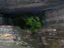
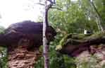
 The formations are sandstone, so soft and porous that plant life doesn't need
soil to live. The flowers, and even the trees, are rooted directly into the
rock.
The formations are sandstone, so soft and porous that plant life doesn't need
soil to live. The flowers, and even the trees, are rooted directly into the
rock.

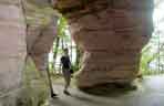

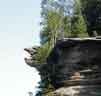
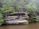
Formations seen on the walk up to Stand Rock.
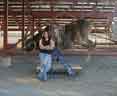
Stand Rock is a table, with about a 6-foot gap between it and the nearby
ledge. See the guy in the first picture? He's a dog trainer. Photographer


 The formations don't exist just at the river. We also toured a lovely canyon
in a horse-drawn carriage.
The formations don't exist just at the river. We also toured a lovely canyon
in a horse-drawn carriage.
The Lost
Canyon is just a few miles south of Wisconsin Dells, in Lake Delton.


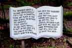
Also in Lake Delton, you can find the Wonder Spot, a clever illusion that makes it feel like the law of gravity has been suspended, or at least misdirected. It's a cabin built on a slant on a steep hill, so that it feels like you're standing crooked when you're standing upright. Water appears to flow uphill, and the guide makes a chair seem to balance on its back legs in a level position.


Psycho card reader? B.L. must be nuts. (Just click it.)
Broadway, Wisconsin Dells.


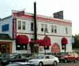
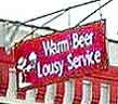 The Showboat Saloon is always busy. Considering the sign they hang out
(above the one that says "Karaoke"), you'd have to wonder why.
The Showboat Saloon is always busy. Considering the sign they hang out
(above the one that says "Karaoke"), you'd have to wonder why.
"Warm Beer, Lousy Service"
There have been several bad jokes this year about flying airplanes into
buildings. As in so many other things, Wisconsin Dells got there first.
Believe it or not.
After a couple of very pleasant days at the Dells, it was time to move on. We were still blessed with zero or light headwinds, so it began to look like it would be reasonable to fly all the way to Rapid City (S.D.) the next day. I laid out a route that would take us through Iowa toward Sioux City and the Floyd monument (this year begins the 200th anniversary of the Lewis and Clark Expedition), and onward to Rapid City via Yankton, but this was not to be.
A line of convective activity formed overnight to the west of the Dells and stretched southwestward, making my plan untenable. However, we were able to fly around the storms to the north. After we took a roundabout route to land at Winona, Minn., it was clear sailing (?) from there on. While taxiing in at Winona, we saw a golden eagle on the infield. The line guy told us that was normal there.
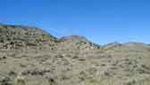
We flew from Winona to Rapid City by way of Sioux Falls, S.D., and Pierre. Talk about hostile terrain, especially west of Pierre. And these aren't even the "official" badlands! At home we worry a lot about being forced down over water, but I sure would not like having to land on some of the stuff we flew over in South Dakota. Sorry, no photos. Just imagine your typical moonscape.
But we got to Rapid City just fine, and checked into a very nice hotel - thanks to the services of Jetstream Aviation and their corporate connections. Jetstream appears to be the #2 FBO at KRAP (they need to work on that airport ID), and they really do try harder.
In Rapid City, the expansion joints in the streets are spaced just right to make each passing car sound like a trotting horse.
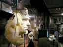
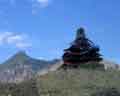
You can't go to Rapid City and not visit Mt. Rushmore, which we did the next morning. The bust is of Gutzon Borglum, the sculptor. There's a small museum associated with the monument, where they show how Borglum worked from a scale model to decide where to place his dynamite. Most of the work was done with dynamite and jackhammers. One of the studies in the museum indicates that Borglum was considering a sculpture of whole bodies, not just busts.


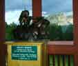
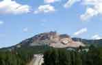
 A few miles west of Mt. Rushmore is the
Crazy Horse National Monument. There
is a lot to see here. In the restaurant, you can study a small bronze model to
see what the mountain will eventually look like when the project is completed.
It's very hard to grasp the enormity of this thing; the second photo was taken
from about a mile and a half away. There is a larger model sculpture
elsewhere in the museum, which also gives the visitor an opportunity to study
the future of the monument.
A few miles west of Mt. Rushmore is the
Crazy Horse National Monument. There
is a lot to see here. In the restaurant, you can study a small bronze model to
see what the mountain will eventually look like when the project is completed.
It's very hard to grasp the enormity of this thing; the second photo was taken
from about a mile and a half away. There is a larger model sculpture
elsewhere in the museum, which also gives the visitor an opportunity to study
the future of the monument.
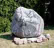
This project has not received any federal funds
at all since it began in 1948. One of the ways they help finance it is to
sell souvenir rocks that are left over from the blasting. But they do want
you to be careful with those rocks.

Detail from the model sculpture at the Crazy Horse Monument.
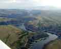
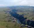
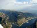
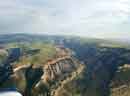
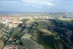
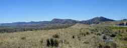
Because N9413L is lousy at high density altitudes when heavily loaded, we flew around the Bighorn Mountains rather than over them. About half an hour before landing at Cody, we flew over the Bighorn Canyon National Recreational Area. It's 2200 feet down from the rim of the canyon to its bottom.

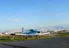 Made it! 1731 nautical miles and 21 flight hours later, N9413L is finally
tied down at Cody. I thought I was in the running for longest distance in a
2-place Grumman, but Mark Conner came from Palmetto, Florida - about 50 NM
farther, by great circle distance. Carol Klein beat us both by a comfortable
margin, flying her
Made it! 1731 nautical miles and 21 flight hours later, N9413L is finally
tied down at Cody. I thought I was in the running for longest distance in a
2-place Grumman, but Mark Conner came from Palmetto, Florida - about 50 NM
farther, by great circle distance. Carol Klein beat us both by a comfortable
margin, flying her
Greg Amy took a somewhat different route from Connecticut to the convention, and has also posted photos on the web.
 Over 280 people were there, in 144 Grummans.
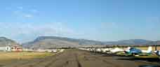
 There isn't much grass at the airport. It seems there isn't much grass in
Wyoming. But nothing explained why they planted plastic grass. It
was laid out in several colors, in grids. At least it's easy to keep it
mowed.
There isn't much grass at the airport. It seems there isn't much grass in
Wyoming. But nothing explained why they planted plastic grass. It
was laid out in several colors, in grids. At least it's easy to keep it
mowed.
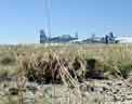
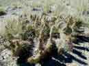 Nearby, there's cactus. Not plastic.

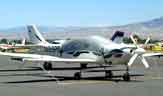
Lancair?
Look closer at the nose.
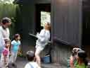
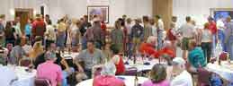
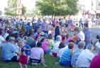
Some lunchtime announcements.

Ni Thomas is easy to find in a crowd.


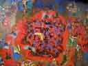
This painting hangs in the convention hotel's bar. The bar is called, well,
you know...
On the first convention night, a caller tried to teach us how to dance. It started out slowly, but after a while folks got into the spirit of the thing.
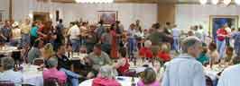
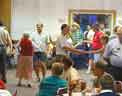
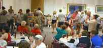
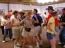 Some of the AYA big shots were caught in the act.
Photo by Greg Amy
I don't have very many photos of the convention itself. That job was
masterfully done by Steve Williams in his
daily coverage of the convention.
 On the first day of the convention, we took a bus tour of Yellowstone
National Park. Theodore Roosevelt called the road from Cody to the Park's
East Gate "the most scenic 50 miles in America," and it richly deserves that
praise. Some of the scenery outside the park is more breathtaking that what
lies inside. Most of the area is national forest land.
On one hilltop that's private, Francis Lee Smith started building a cabin
for his family, and didn't know when to stop. He just kept adding rooms and
balconies until he fell to his death in 1992. Since then, the
Smith Mansion, or
"Pagoda," has been abandoned.
On the first day of the convention, we took a bus tour of Yellowstone
National Park. Theodore Roosevelt called the road from Cody to the Park's
East Gate "the most scenic 50 miles in America," and it richly deserves that
praise. Some of the scenery outside the park is more breathtaking that what
lies inside. Most of the area is national forest land.
On one hilltop that's private, Francis Lee Smith started building a cabin
for his family, and didn't know when to stop. He just kept adding rooms and
balconies until he fell to his death in 1992. Since then, the
Smith Mansion, or
"Pagoda," has been abandoned.
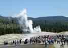
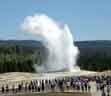
 If the park is a show, then Old Faithful is surely its star. Our guides
made certain that we were treated to an eruption. Some of us preferred the
view from the lodge balcony to the crowds on the observation deck, even
though we were a little farther away.
If the park is a show, then Old Faithful is surely its star. Our guides
made certain that we were treated to an eruption. Some of us preferred the
view from the lodge balcony to the crowds on the observation deck, even
though we were a little farther away.
 The clock inside the lodge at Old Faithful. Its pendulum is about fifteen
feet long.
The clock inside the lodge at Old Faithful. Its pendulum is about fifteen
feet long.
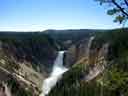
Lower Falls, in Yellowstone's Grand Canyon.
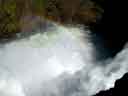
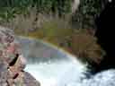
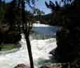
The Upper Falls are also in the Grand Canyon, and not so steep as the Lower
Falls. But you can always catch a rainbow there.
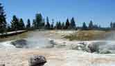
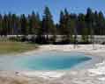
The trail around the Fountain Paint Pot is interesting because it wanders directly past each of the four distinct hydrothermal features to be found in Yellowstone Park: geyser, mud pot, fumarole, and hot spring.
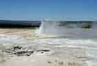 The Fountain Geyser erupts continuously. Twig Geyser is in the foreground.
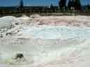
Fountain Paint Pot.
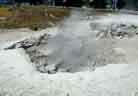 A fumarole, or steam vent, has so little water that all the water boils before
it reaches the surface. If it had more water, it would be a geyser or a hot
spring. They make a lot of noise and they don't smell very good. The
Yellowstone River gets its name from the sulfur in its rocks.
A fumarole, or steam vent, has so little water that all the water boils before
it reaches the surface. If it had more water, it would be a geyser or a hot
spring. They make a lot of noise and they don't smell very good. The
Yellowstone River gets its name from the sulfur in its rocks.
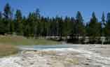
 Silex Spring is about 190°F (94°C).
If the opening is not the right size and shape to form a geyser, the result is
a hot spring.
Silex Spring is about 190°F (94°C).
If the opening is not the right size and shape to form a geyser, the result is
a hot spring.


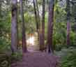
 Trees in Yellowstone Park. The first two are near the Fountain Paint Pot;
the last, on the trail down to the Lower Falls.
Trees in Yellowstone Park. The first two are near the Fountain Paint Pot;
the last, on the trail down to the Lower Falls.
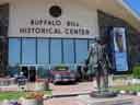 The
Buffalo Bill Historical Center
is so big that your admission fee is good for two consecutive days.
Cody truly has a world-class museum here. Actually, there are five museums
on the property.
The
Buffalo Bill Historical Center
is so big that your admission fee is good for two consecutive days.
Cody truly has a world-class museum here. Actually, there are five museums
on the property.
The Buffalo Bill Museum examines Buffalo Bill's personal and private lives.
The Whitney Gallery of Western Art is a collection of works treating the American West. Frederic Remington's studio has also been reproduced here.
The Cody Firearms Museum houses the world's most complete collection of American firearms, and some European arms as old as the 16th century. If the 1500 guns in the main part of the museum weren't enough to keep a visitor interested, there's a sign directing him to 1200 more on the lower level.
The Plains Indian Museum contains Indian art and artifacts, and explores the culture, history, and traditions of the Plains Indians.
The Draper Museum of Natural History is the Historical Center's newest wing. Its focus is on the Greater Yellowstone Ecosystem.
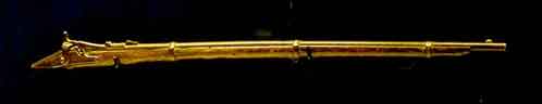
Lucretia Borgia.
Buffalo Bill's 1866 Springfield, which he used on the hunt that earned him
his nickname. Somewhere along the line, the stock was lost.
 The buffalo
exhibit has samples of the winter and summer hides (fur, no fur) that the
visitor is encouraged to touch.
The buffalo
exhibit has samples of the winter and summer hides (fur, no fur) that the
visitor is encouraged to touch.

Buffalo Bill and the Indians.
From a sign nearby:
As early as 1878, Cody was quoted as saying, " Every Indian outbreak that I have ever known has resulted from broken promises and broken treaties by the government." When he was asked for his solution to the Indian "problem," he replied, "never make a single promise to the Indians that is not fulfilled."
Indians of his day considered Cody a good friend, and his relationship with them was characterized by mutual respect. America, Cody stressed, was the Indian's heritage. He had only fought for what was his and should expect to be treated with fairness and justice. Most of the Indians who toured with the Wild West were veterans of the wars, and many had known Cody on the plains.
According to Black Elk, Luther Standing Bear, and others, the Indians were treated as equals in the arena and behind the scenes. As many as 80 Indians at a time, mostly Sioux, were allowed by the government to travel with the Wild West.
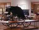
 It's a museum piece now, but this chuck wagon was a working vehicle on a
Montana ranch until the 1960s.
It's a museum piece now, but this chuck wagon was a working vehicle on a
Montana ranch until the 1960s.
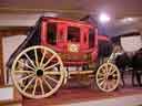
Contemporary carriages.


Demonstrating the leatherworker's art, and one of the final products. The
saddle and its stand were made around 1934 by Edward H. Bohlin for a movie
company. The saddle set features a breast collar, tapaderos, bridle, and
serape.

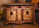 Modern furniture in the spirit of Buffalo Bill.
The sideboard was made in 1994 by Rod Skenadore. Materials are walnut,
juniper, cedar, driftwood, fir, pine, lodgepole (pine), and leather. The
covering is water buffalo.
The daybed is a little newer (1998). It's covered in hide and tooled
leather. The legs and rails are steerhorn. It opens to a full-size bed.
Modern furniture in the spirit of Buffalo Bill.
The sideboard was made in 1994 by Rod Skenadore. Materials are walnut,
juniper, cedar, driftwood, fir, pine, lodgepole (pine), and leather. The
covering is water buffalo.
The daybed is a little newer (1998). It's covered in hide and tooled
leather. The legs and rails are steerhorn. It opens to a full-size bed.
 This coat is made of a combination of Russian furs. It was given to Buffalo
Bill in 1872, by Alexis and his father, Tsar Alexander II.
This coat is made of a combination of Russian furs. It was given to Buffalo
Bill in 1872, by Alexis and his father, Tsar Alexander II.
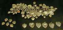 This sterling silver charm bracelet originally had 67 hearts engraved with the
names of performers and performing groups. The cast of Buffalo Bill's Wild
West gave it to Irma Cody in 1899.
This sterling silver charm bracelet originally had 67 hearts engraved with the
names of performers and performing groups. The cast of Buffalo Bill's Wild
West gave it to Irma Cody in 1899.
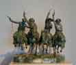
Here is a microscopic sample of what we saw in the Whitney Gallery:
 Allan Mardon, 1931-
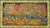
Battle of Greasy Grass (1996)
This mural-sized painting (6 x 11 feet) is the centerpiece of an
exhibit called The Battle of Many Names. Details focus on Custer and
Sitting Bull.
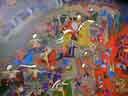
 Thom Ross, 1952-
Burial at Sea (1999)
"Old Charlie, Cody's beloved veteran horse, died on the Wild West Company's
voyage from Europe back to New York in the spring of 1888. Wrapped in canvas
and covered with the stars and stripes of the American flag, Old Charlie was
given an honorable burial at sea on May 17."

 Gutzon Borglum, 1867-1941
Mares of Diomedes (1904)
Although the title refers to one of the Labors of Hercules, Borglum admitted
that it was a convenience: "I have utilized a subject from the West -
the stealing of horses." Just a few days ago, we had enjoyed one of
Borglum's other works at Mt. Rushmore.
 Sally James Farnham, 1869-1943
The Sun Fisher (1920)
Sally James Farnham had no formal artistic training. She began modelling in
clay while recuperating from an illness. Although she was a New Yorker, she
travelled in western Canada and in Wyoming.
 Fred Fellows, 1934-, No Easy Way Out (1991)

Bob Scriver, 1914-1999, An Honest Try (1968-1997)
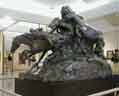
 Frederic Remington, 1861-1909
Coming Through the Rye (1902-1907)
Remington studied the movement of horses from Muybridge's stop-action
photography. This sculpture was a challenge because the artist wanted as
many horses' hooves off the ground as possible, but still had to support the
sculpture.
 Frederic Remington's New Rochelle studio has been reproduced here.
 In a museum with almost 3000 guns, it's hard to pick a good sample, so here's
only one. It's a melon patch gun, designed to be used in groups of four.
One gun is positioned at each corner of the melon patch, and they are
connected by trip wires. When a thief moves one of the wires, the gun
pivots in his direction and fires.
In a museum with almost 3000 guns, it's hard to pick a good sample, so here's
only one. It's a melon patch gun, designed to be used in groups of four.
One gun is positioned at each corner of the melon patch, and they are
connected by trip wires. When a thief moves one of the wires, the gun
pivots in his direction and fires.


At the back of the gun museum there is a recreation of a hunting lodge,
decorated with the stuffed heads of more animals than you could imagine. The
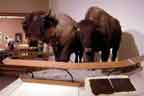
front of the lodge is guarded by these two northern bears.
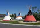
 The Plains Indian museum is full of artifacts and displays. Some of the
larger ones, like this tepee, were constructed for the museum. The
interpretive audio is synchronized with the lighting so that different parts
of the interior are emphasized as the tape explains them.
The Plains Indian museum is full of artifacts and displays. Some of the
larger ones, like this tepee, were constructed for the museum. The
interpretive audio is synchronized with the lighting so that different parts
of the interior are emphasized as the tape explains them.


The tepee, and these exhibits, are mainly Crow. This is one of the tribes
that have lived around Cody for a long time.

The museum has a few items from other parts of North America as well. This is
Haida, from the Pacific coast.

 There is a large multi-media presentation in the museum, in a space about 40
feet high. You get the feeling that you experience all seasons, and time
from sunrise, through sunset, through the night to the following morning.
There is a large multi-media presentation in the museum, in a space about 40
feet high. You get the feeling that you experience all seasons, and time
from sunrise, through sunset, through the night to the following morning.
The grounds are also part of the museum. There are gardens among the several wings of the historical center, with their own sculpture. Some of the sculpture is natural.

 The cottonwood tree is loved in the dry West. Its presence always meant that
water would be found nearby.
The cottonwood tree is loved in the dry West. Its presence always meant that
water would be found nearby.
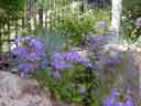
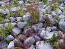
 The orange blooms are Indian Paintbrush, Wyoming's state flower.
 Both pieces are by Richard V. Greeves, who lives on the Wind River Indian
Reservation in Wyoming. This is The Unknown.
Both pieces are by Richard V. Greeves, who lives on the Wind River Indian
Reservation in Wyoming. This is The Unknown.
 Crazy Horse. The inscription on the pedestal reads
American Hero
Crazy Horse
Killed 1877 defending his country

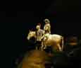
Sacagawea, by Harry Jackson.

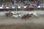

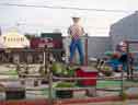
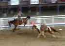
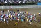
One night, we all went to the rodeo.
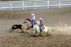
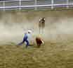


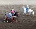
 Special event for kids 12 and younger. They were chasing a calf,
to pull off a ribbon that was tied to the calf's tail.
That was a very safe ribbon.
Special event for kids 12 and younger. They were chasing a calf,
to pull off a ribbon that was tied to the calf's tail.
That was a very safe ribbon.
The only bull that you could stay on for more than 8 seconds.
Maybe.
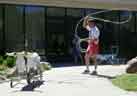
Back at the museum, there was an area just off the gun wing where they taught kids (well, mostly kids) how to do some of the rodeo events.


 Every day at 6 PM, the staff of the Irma Hotel closes the street and stages a
shootout. (Buffalo Bill Cody built the hotel, and named it for his youngest
daughter.) A crowd starts gathering about half an hour before the production
begins.
Every day at 6 PM, the staff of the Irma Hotel closes the street and stages a
shootout. (Buffalo Bill Cody built the hotel, and named it for his youngest
daughter.) A crowd starts gathering about half an hour before the production
begins.
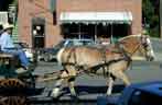
Then the carriage (used for local tours) leaves, ...

 ...
and the actors start the preliminaries.
After a brief lecture about gun safety and some introductions, they give away
a few of their promotional posters.
...
and the actors start the preliminaries.
After a brief lecture about gun safety and some introductions, they give away
a few of their promotional posters.
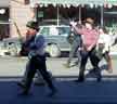
 Then they get down to business.
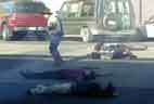

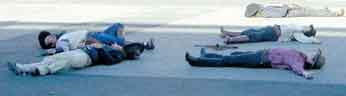
You know the bad guys are all going to end up dead.

But you don't know that the last one will quit dying just long
enough for them all to stand up and pose for a few pictures.
Before they're done, they do remember to finish dying.

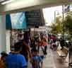
 You can't pack enough clothes for a two-week trip, so we spent a little time
in the laundromat. Cody's had signs that you just wouldn't see in
Connecticut. For instance, I never worried about emptying the bullets from
my pockets before washing clothes.
You can't pack enough clothes for a two-week trip, so we spent a little time
in the laundromat. Cody's had signs that you just wouldn't see in
Connecticut. For instance, I never worried about emptying the bullets from
my pockets before washing clothes.
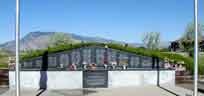
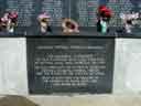
The people of Wyoming have their own memorial to the dead and missing from the Vietnam years, a short walk from the Cody airport.

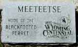
 As advertised,
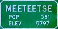
Meeteetse isn't very big. The town, about 30 miles south of
Cody, has at least three claims to fame, though.
As advertised,
Meeteetse isn't very big. The town, about 30 miles south of
Cody, has at least three claims to fame, though.
We took a drive down there on the last convention day, when there wasn't much going on at the airport except for the air race. Actually, most of that wasn't at the airport, either.
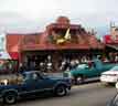
 1. Butch Cassidy and the Sundance Kid were once arrested here, outside the
Cowboy Bar. The bar is now called the Outlaw Parlor Cafe, but it's the same
place, and the bar inside still has bullet holes. If you look closely, you'll
see that the town has maintained the wood sidewalks that were necessary when
the streets weren't paved. The burgers are good. We were served by a very
pleasant lady who told us what it's like to move to a town of 351 souls, get
divorced, and have to see your ex-husband every day.
1. Butch Cassidy and the Sundance Kid were once arrested here, outside the
Cowboy Bar. The bar is now called the Outlaw Parlor Cafe, but it's the same
place, and the bar inside still has bullet holes. If you look closely, you'll
see that the town has maintained the wood sidewalks that were necessary when
the streets weren't paved. The burgers are good. We were served by a very
pleasant lady who told us what it's like to move to a town of 351 souls, get
divorced, and have to see your ex-husband every day.

2. Little Wahb, probably the largest grizzly bear ever killed in Wyoming
(maybe also in the lower 48 states), was taken near here.
He was over eight feet tall.
 3. The black-footed ferret was thought to be extinct until one was discovered
at the Pitchfork Ranch, about 15 miles from Meeteetse. The animals were
captured, bred, and released successfully into the wild near that site. They
are sometimes, but not often, sighted near that place and others along the
Greybull River (runs through both Pitchfork and Meeteetse). We started out to
drive to Pitchfork, but thought better of it when we realized that there was
very little chance that we'd actually see one of these animals. So we
reluctantly settled for this statuette, and a stuffed ferret in Meeteetse's
Charles Belden Western Photography Museum. The museum did not say whether their
ferret was stuffed before or after it was decided the animal was no longer
extinct.
3. The black-footed ferret was thought to be extinct until one was discovered
at the Pitchfork Ranch, about 15 miles from Meeteetse. The animals were
captured, bred, and released successfully into the wild near that site. They
are sometimes, but not often, sighted near that place and others along the
Greybull River (runs through both Pitchfork and Meeteetse). We started out to
drive to Pitchfork, but thought better of it when we realized that there was
very little chance that we'd actually see one of these animals. So we
reluctantly settled for this statuette, and a stuffed ferret in Meeteetse's
Charles Belden Western Photography Museum. The museum did not say whether their
ferret was stuffed before or after it was decided the animal was no longer
extinct.
 Meeteetse's visitor information center is in the Charles Belden Museum.
Although this museum is mainly concerned with Belden's photography, it is
also a good representation of life in the area, a hundred years ago.
Belden's darkroom and office have been reconstructed here. There are also
reconstructions of other rooms as they were at the turn of the twentieth
century, and many artifacts from the period from about
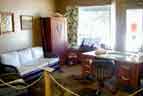
Meeteetse's visitor information center is in the Charles Belden Museum.
Although this museum is mainly concerned with Belden's photography, it is
also a good representation of life in the area, a hundred years ago.
Belden's darkroom and office have been reconstructed here. There are also
reconstructions of other rooms as they were at the turn of the twentieth
century, and many artifacts from the period from about

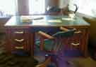
 The armoire in the office features Belden's insignia, the antelope head.
It also has the brand of the Pitchfork Ranch, but that's not visible in the
photo.
This piece, and some of the other furniture in Belden's house on the
Pitchfork ranch, were made by Molesworth, a famous western furniture maker.
The office and bedroom set were once on display at the Gene Autry Museum.
The armoire in the office features Belden's insignia, the antelope head.
It also has the brand of the Pitchfork Ranch, but that's not visible in the
photo.
This piece, and some of the other furniture in Belden's house on the
Pitchfork ranch, were made by Molesworth, a famous western furniture maker.
The office and bedroom set were once on display at the Gene Autry Museum.
 The turn-of-century bank is also a museum, but it wasn't open on the day we
visited. The wood sidewalks are more obvious here than in the picture of the
Cowboy Bar.
The turn-of-century bank is also a museum, but it wasn't open on the day we
visited. The wood sidewalks are more obvious here than in the picture of the
Cowboy Bar.
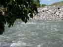
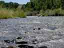 The Greybull River runs through the Pitchfork Ranch on its way to Meeteetse.
It's an excellent trout stream.
The Greybull River runs through the Pitchfork Ranch on its way to Meeteetse.
It's an excellent trout stream.
This car was in Meeteetse, but it would have been right at home back in
Put-in-Bay.
 As we got ready to leave Cody, the heat wave was still on. So we decided to
head back via Wisconsin, which was still relatively cool. This time we aimed
for
Door County. The county takes its name from the dangerous straits
connecting Green Bay to Lake Michigan between the peninsula and Washington
Island. The voyageurs called this place Death's Door, after a similar name
that had already been used by the native Indians for centuries. As one might
expect, there are plenty of shipwrecks in the area.
Door County has more lighthouses than any other single county in the U.S.
As we got ready to leave Cody, the heat wave was still on. So we decided to
head back via Wisconsin, which was still relatively cool. This time we aimed
for
Door County. The county takes its name from the dangerous straits
connecting Green Bay to Lake Michigan between the peninsula and Washington
Island. The voyageurs called this place Death's Door, after a similar name
that had already been used by the native Indians for centuries. As one might
expect, there are plenty of shipwrecks in the area.
Door County has more lighthouses than any other single county in the U.S.
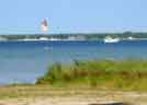
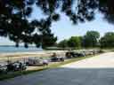
 Being a narrow peninsula, Door County has plenty of beach. These guys were
sailing some contraption that looks like part parachute, part surfboard.
The photos were taken at Bailey's Harbor, home of two other attractions: the
Cana Island Light and the Ridges Sanctuary.
Being a narrow peninsula, Door County has plenty of beach. These guys were
sailing some contraption that looks like part parachute, part surfboard.
The photos were taken at Bailey's Harbor, home of two other attractions: the
Cana Island Light and the Ridges Sanctuary.
The Cana Island Light is the most-often photographed lighthouse in Wisconsin, and probably also one of the most-photographed in the country. To reach it, you walk along a causeway that is often flooded - most of the time, there's no way to get there with dry feet, knees, or maybe even thighs. The day we were there, the lake level was down a couple of feet (it's been a dry year so far), so we didn't have to wade. Then there's a pleasant path through a little woods, and finally the lighthouse.


No shortage of gulls on Cana Island.
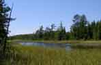
 The Ridges are best explained with the help of a photo lifted from the
organization's
website.
Lake Michigan's waves have deposited row after row of sand, so that the area
has taken on the appearance of a series of waves carved in sand. Forest
grows on the crests, and the swales are swamplike or submerged completely.
This topography supports a wide variety of plants and wildlife.
The Ridges are best explained with the help of a photo lifted from the
organization's
website.
Lake Michigan's waves have deposited row after row of sand, so that the area
has taken on the appearance of a series of waves carved in sand. Forest
grows on the crests, and the swales are swamplike or submerged completely.
This topography supports a wide variety of plants and wildlife.

 The Ridges are also home to the old Bailey's Harbor range lights. There's a
modern self-contained range now, so these lights are out of service. But the
structures are maintained for historical interest. Range lights are useful
in navigation: when they appear to be lined up, you're in the right spot.
If there's a straight-line channel dredged along the line of the ranges, so
much the better. This is the case at Bailey's Harbor, where the modern range
guides returning vessels through deep water.
The Ridges are also home to the old Bailey's Harbor range lights. There's a
modern self-contained range now, so these lights are out of service. But the
structures are maintained for historical interest. Range lights are useful
in navigation: when they appear to be lined up, you're in the right spot.
If there's a straight-line channel dredged along the line of the ranges, so
much the better. This is the case at Bailey's Harbor, where the modern range
guides returning vessels through deep water.
 At the Ridges, there are several trails, most of which cross the
boardwalk connecting the two old range lights.
At the Ridges, there are several trails, most of which cross the
boardwalk connecting the two old range lights.
The upper range light (right photos) is now a private residence, so you can't get too close without trespassing.
Scenes inside the Ridges.

 Bird blind.
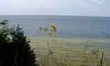
Death's Door, the straits between the peninsula and Washington Island. Washington Island is in the background of the second picture.

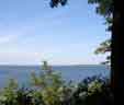

 There's a catwalk at Ellison Bluff that takes you go down to get a good view.
The end of the walk is built out over the water, where you get the feeling
of suspension in space. The view to the left is of Peninsula
State Park and Chambers Island.
There's a catwalk at Ellison Bluff that takes you go down to get a good view.
The end of the walk is built out over the water, where you get the feeling
of suspension in space. The view to the left is of Peninsula
State Park and Chambers Island.

 The view straight down is impressive, too.
Those dead trees at lower right used to be
The view straight down is impressive, too.
Those dead trees at lower right used to be

This lighthouse is at Peninsula State Park's Eagle Bluff, a high point on
Green Bay. The background in the second photo is water, not air. It's a
long way down.
 This Fish Creek cabin, built in 1849, is identified as the birthplace of
Edgar Thorp. Thorp was part-owner and crew of the
This Fish Creek cabin, built in 1849, is identified as the birthplace of
Edgar Thorp. Thorp was part-owner and crew of the

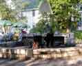
 A visit to Door County would not be complete without a fish boil.
As a friend respectfully (more or less) asked, "What the hell is a fish
boil?"
A visit to Door County would not be complete without a fish boil.
As a friend respectfully (more or less) asked, "What the hell is a fish
boil?"
It's a Door County specialty, left over from lumberjack days. The cook in a
lumber camp had to feed a lot of men quickly and easily, so this is what they
came up with:
For each person you'll be feeding, you will need:
3 small, peeled onions
3 small new potatoes
1 pound of whitefish, cut into chunks
1 cup of salt per 3 gallons of water
Freshly melted butter
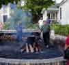
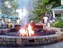
The popular way to build the fire for the cauldron in Door County is to stand the halved firelogs on end, leaning them against the bottom of the cauldron. This allows the heat to become more focused on the bottom of the pot.
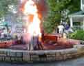
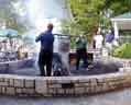
Add the salt to the water in the cauldron and begin building the fire. Once the water begins to boil, throw in the potatoes and let boil for 10 minutes. Then, add the onions. Build up the fire more and let the onions boil for 7 minutes. Build up the fire some more. Once the water is strongly boiling, add the fish and allow to boil for 9 minutes. Build up the fire once more and allow the water to boil over. This is usually done by throwing at least a quart of kerosene onto the fire. Drain and serve the fish, potatoes and onions with plenty of melted butter.
It's not a real fish boil unless you have cherry pie (another Door County specialty) for dessert.
As the cook moves things along, he periodically adds "a pinch" of salt. His pinch weighs about two pounds. He explains that this isn't to affect the taste of the food so much as to raise the specific gravity of the water in the pot. This way, the oils will float to the top where he skims them off. At the right moment he throws a can full of kerosene onto the fire, which makes the pot boil over. This carries off all the oils and fat. After the boil-off, they pull the fish, potatoes, and onions out, and dinner is served.
There were no onions in the recipe pictured here. We went to the White Gull in Fish Creek, where the cook believes that onions overpower the taste of the fish. The meal was excellent, so who are we to argue? Besides, curiosity about the difference will give us a reason to go back to Door County.

After dinner, it's a short stroll down the path to Sunset Beach, where we watched the evening performance over Chambers Island.

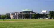
 We spent our last day on the road in Toronto. This is the city's most
important building, well-known to tourists and natives alike. It's where
Ontario's laws are made. I couldn't find the building where they make the
sausage.
We spent our last day on the road in Toronto. This is the city's most
important building, well-known to tourists and natives alike. It's where
Ontario's laws are made. I couldn't find the building where they make the
sausage.
 Some would say that this building also identifies Toronto.
It's the world's tallest free-standing structure.
This is the view
from the Island Airport, where we landed. The airport is a two-minute ferry
ride from the mainland. There's no other way to get back and forth, and you
wouldn't want to change a thing about that.
Some would say that this building also identifies Toronto.
It's the world's tallest free-standing structure.
This is the view
from the Island Airport, where we landed. The airport is a two-minute ferry
ride from the mainland. There's no other way to get back and forth, and you
wouldn't want to change a thing about that.
 Toronto Hydro Corporation, the electric company.


From a stroll around Queen's Park, just north of the Parliament Building.
The statue is King Edward VII. It originally stood in Edward Park, Delhi,
India. It was given to the City of Toronto in 1969.
 Black squirrels are common here, but we never see them in Connecticut.
 Something else that's not common at home is groups of Falun Dafa
practitioners. Here they are on the front lawn of the Ontario Parliament.
We also saw groups of them exercising on the front lawn of the Houses of
Parliament in Ottawa last year.
Something else that's not common at home is groups of Falun Dafa
practitioners. Here they are on the front lawn of the Ontario Parliament.
We also saw groups of them exercising on the front lawn of the Houses of
Parliament in Ottawa last year.

Toronto subway.
The city's bigger than you'd think from just looking at a map. It's well
worth it to get a
day pass, which is good for any mode of public transport,
including the trolleys.
University of Toronto.


 Sculpture at the University of Toronto.
This one is in front of an engineering building, natch.
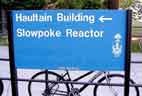 So... where's the fast reactor?
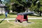 From the bottom of the sea. The cannon is the subject of the picture, but
the woman with the fish balloon kept parading about for several minutes.
Maybe she was waiting for
someone who was told to recognize her by the balloon. The
plaque explains the cannon but not the fish balloon.
From the bottom of the sea. The cannon is the subject of the picture, but
the woman with the fish balloon kept parading about for several minutes.
Maybe she was waiting for
someone who was told to recognize her by the balloon. The
plaque explains the cannon but not the fish balloon.
Rush hour for statues?
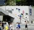
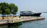
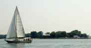
Scenes from a hazy afternoon's walk along the harbor. We saw all kinds of transportation: kayaks, several kinds of sailing and powered boats, a blimp, airplanes, and a helicopter that hovered over the CN Tower for five minutes (we timed it).


 That's Air Nova's Dash-8 on short final for the island
airport's runway 26. The runway threshold is about halfway between the
airplane and the hangar to the right in the photo.
That's Air Nova's Dash-8 on short final for the island
airport's runway 26. The runway threshold is about halfway between the
airplane and the hangar to the right in the photo.

There was also some thing we couldn't find a name for.
It seemed to be sweeping up floating trash.

There's something fishy about this sidewalk.
 Right in the middle of all this development, a small parcel has been allowed
to revert to its original wild state.
The birdhouse is designed to look like buildings that stood on the site at
the beginning of the 20th century.
This explanation is adapted from signs on the site:
Right in the middle of all this development, a small parcel has been allowed
to revert to its original wild state.
The birdhouse is designed to look like buildings that stood on the site at
the beginning of the 20th century.
This explanation is adapted from signs on the site:
The Spadina Quay Wetland is part of the
The wetland concept was sparked by reports from anglers of large adult pike being caught near the marina at the foot of Spadina Quay. Sampling reports confirm that mature northern pike return each spring to spawn in this area.
Although small in size, the Spadina Quay Wetland demonstrates the potential
to transform a parking lot into a diverse and stable ecosystem. A series of
features provide a new home for spawning fish, amphibians and marsh birds as
well as a wonderful recreational area for local residents and visitors. The
 Too soon, it's time to head for home.
3549 nautical miles (just over 4000 statute miles)
14 states and one Canadian province
All five Great Lakes plus the Georgian Bay
40:09 hours block-to-block
36:48 hours in the air
much more time on the ground - "priceless"