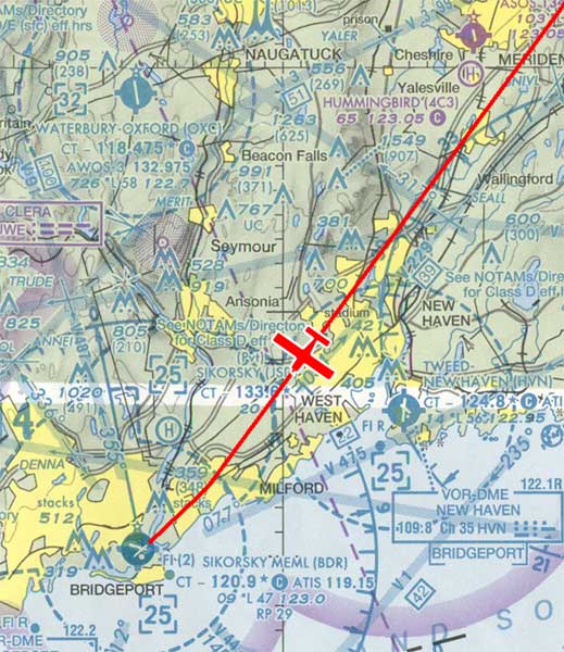
At a recent fly-in, another pilot remarked how it's not easy to spot the home 'drome when arriving from the Northeast. Being based there, I don't think about it much; but on the way home (from the Northeast), I realized he was right, especially on a winter afternoon when the airport is between the pilot and the setting sun.
Here's the approach path for a four-mile final to Runway 24. To spot BDR, first be sure you've already flown past New Haven. Both are seacoast airports, a couple of miles SE of an urban center. New Haven's airport is just east of the city's wide harbor. Bridgeport airport is west of the Housatonic River, which is much less obvious from a distance.

|
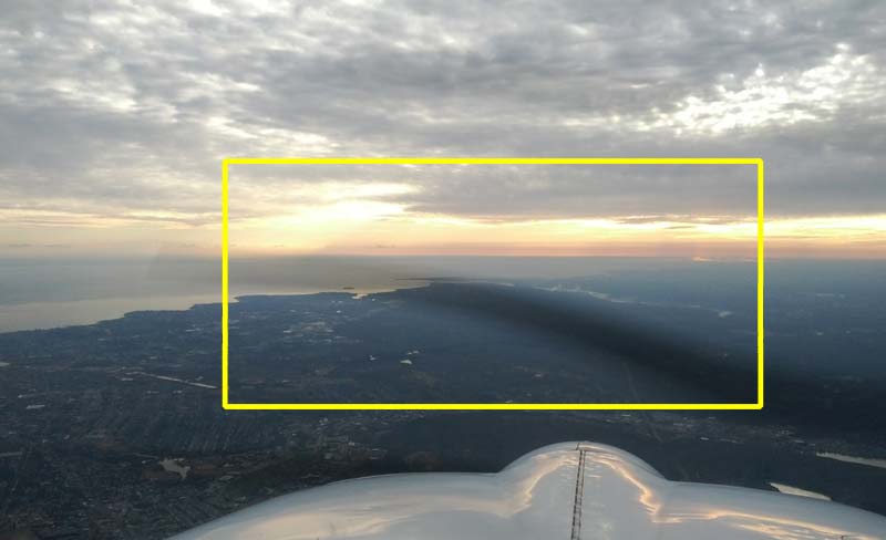
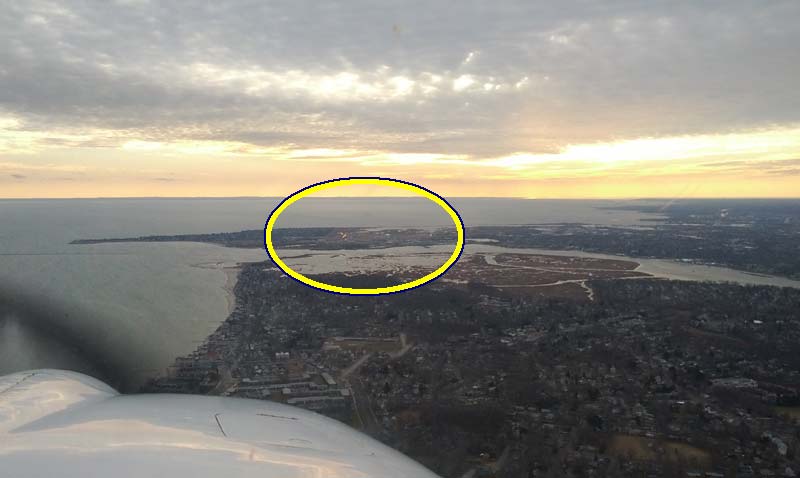
Shortly after passing New Haven, this is the pilot's view toward BDR. All of these photos have been taken on a three-degree descent to the airport.
|
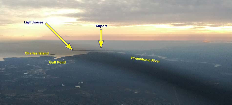
Let's zoom in a little bit.
|
The only one of these landmarks that is clear on the sectional chart is the only one you won't see – the lighthouse. It's the solid dot marked Fl (2), a mile southeast of the airport symbol. Just make a mental note that the airport is in the center of a stubby peninsula, and there's a lighthouse at the end of that.
Charles Island is an unofficial local reporting point, 3.5 NM east of the airport. On the chart, it's the little mark between the two sevens on the course for V475. Low tide uncovers a sand spit connecting the island with the nearby beach. This is the only island in the vicinity. Even though it's not named on the chart, the controllers often expect you to know about it.
From this approach, you may see Milford's Gulf Pond. It's too shallow to be a good harbor, but it's right next to the city's harbor, which is hard to see from this direction. Both are about four miles from the airport, and if the light is just right you'll see the Gulf Pond, which will help you identify Charles Island.
The airport is just beyond the Housatonic River. The last three miles of shoreline point directly to the airport. This is obvious to the instrument pilot who studies the RNAV 24 approach to BDR.
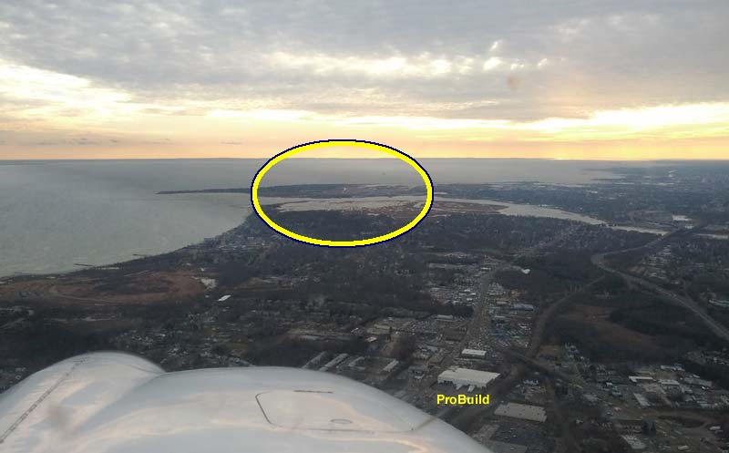
Here's the airport from about five NM final. The white building that's about to be covered by the cowling is a builders' supply warehouse, 3 NM from the threshold. The plane has just passed the Connecticut Post Mall (5-NM final), also known to instrument pilots as MILUM (FAF for BDR RNAV 24).
|
Here we are on 3-mile final. The VASI is visible to the left of the runway, but the airport doesn't really stand out, at least not at this magnification. You're looking for ablout 1½ square miles of clear area – no trees, no buildings. There are two 4700-foot-long runways in there.
|
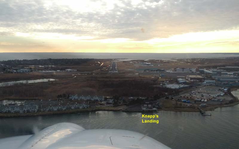
Keep flying parallel to the beach, and you're cleared to land. If you park on the east side of the airport, you're about half a mile from Knapp's Landing, where you can enjoy your meal with a pleasant river view. The patio is open in warm weather. You can also get a light meal at the Windsock Inn, on the airport property.
|
Andrew R. took all the photos. Thanks!